MyTopo
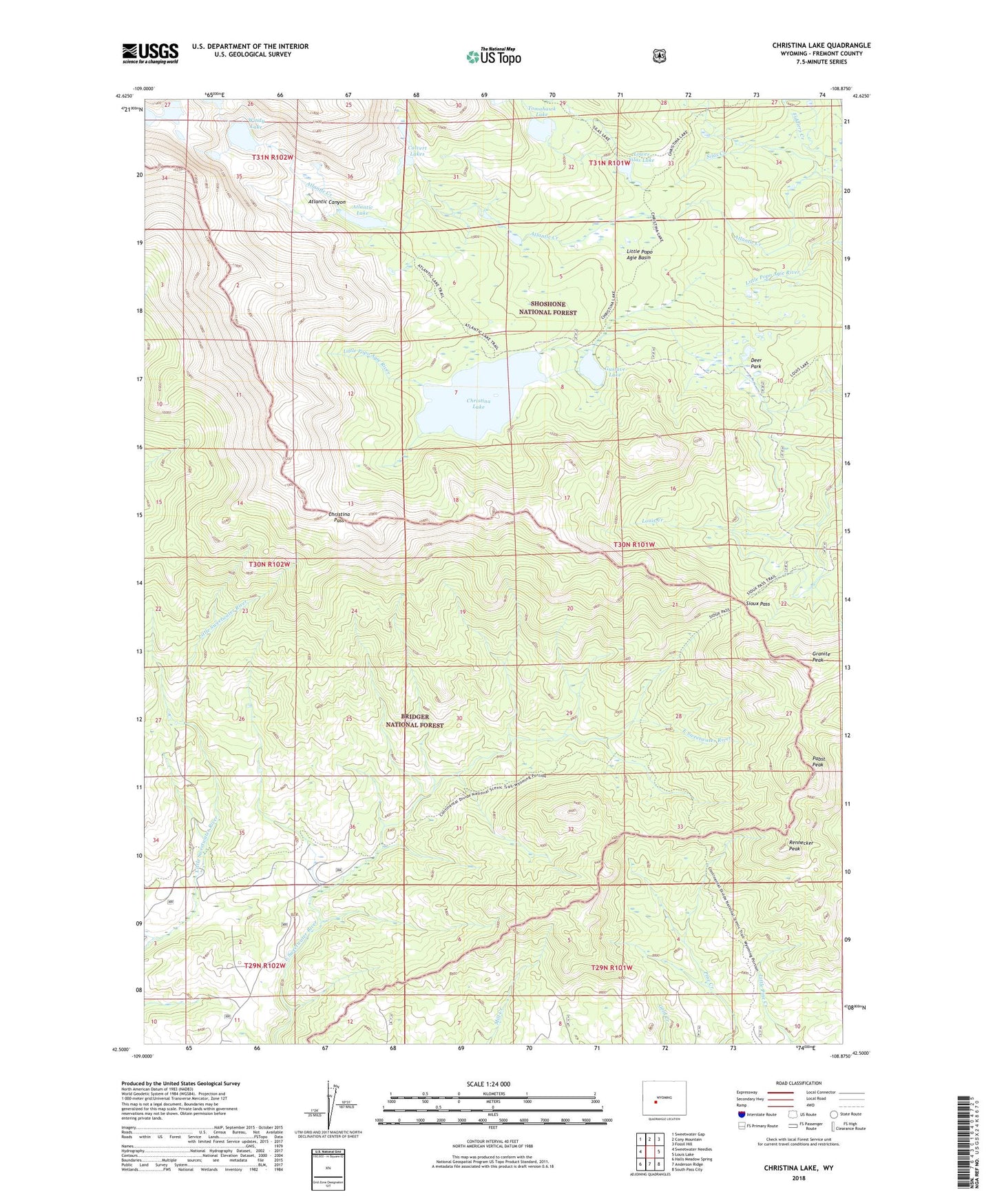
Christina Lake Wyoming US Topo Map
Couldn't load pickup availability
Also explore the Christina Lake Forest Service Topo of this same quad for updated USFS data
2021 topographic map quadrangle Christina Lake in the state of Wyoming. Scale: 1:24000. Based on the newly updated USGS 7.5' US Topo map series, this map is in the following counties: Fremont. The map contains contour data, water features, and other items you are used to seeing on USGS maps, but also has updated roads and other features. This is the next generation of topographic maps. Printed on high-quality waterproof paper with UV fade-resistant inks.
Quads adjacent to this one:
West: Sweetwater Needles
Northwest: Sweetwater Gap
North: Cony Mountain
Northeast: Fossil Hill
East: Louis Lake
Southeast: South Pass City
South: Anderson Ridge
Southwest: Halls Meadow Spring
This map covers the same area as the classic USGS quad with code o42108e8.
Contains the following named places: Atlantic Canyon, Atlantic Lake, Calvert Lakes, Christina Dam, Christina Lake, Christina Lake Trail, Christina Pass, Deer Park, Fiddlers Creek, Granite Peak, Gustave Lake, Little Popo Agie Basin, Little Sweetwater Trail, Lower Silas Lake, Pabst Peak, Pine Creek Trail, Rennecker Peak, Silas Creek, Sioux Pass, Sioux Pass Trail, Tomahawk Lake, Windy Lake