MyTopo
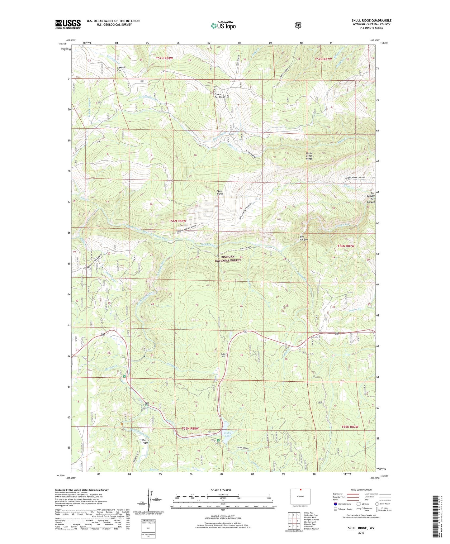
Skull Ridge Wyoming US Topo Map
Couldn't load pickup availability
Also explore the Skull Ridge Forest Service Topo of this same quad for updated USFS data
2021 topographic map quadrangle Skull Ridge in the state of Wyoming. Scale: 1:24000. Based on the newly updated USGS 7.5' US Topo map series, this map is in the following counties: Sheridan. The map contains contour data, water features, and other items you are used to seeing on USGS maps, but also has updated roads and other features. This is the next generation of topographic maps. Printed on high-quality waterproof paper with UV fade-resistant inks.
Quads adjacent to this one:
West: Burgess Junction
Northwest: West Pass
North: Columbus Peak
Northeast: Dayton North
East: Dayton South
Southeast: Walker Mountain
South: Woodrock
Southwest: Granite Pass
This map covers the same area as the classic USGS quad with code o44107g4.
Contains the following named places: Arrowhead Lodge, Blue Creek, Box Canyon, Camp Bethal, Camp Creek, Cooper Claim Mine, Cutler Creek, Cutler Hill, East Fork Sheep Creek, Eureka Ditch, Fool Creek, Freeze Out Cow Camp, Freeze Out Point, Horse Creek, Horse Creek Ridge, Johnson Creek, Marcum Creek, Middle Fork Sheep Creek, Nickle Creek, North Tongue River, Pine Island Picnic Area, Prune Creek, Prune Creek Campground, Sawmill Flat, Sheridan West Division, Shutts Flats, Sibley Lake, Sibley Lake Dam, Sibley Lake Recreation Area, Skull Ridge, South Tongue Campground, South Tongue River, Tie Creek, West Fork Sheep Creek, Yonkee Cow Camp, ZIP Code: 82836