MyTopo
Dayton South Wyoming US Topo Map
Couldn't load pickup availability
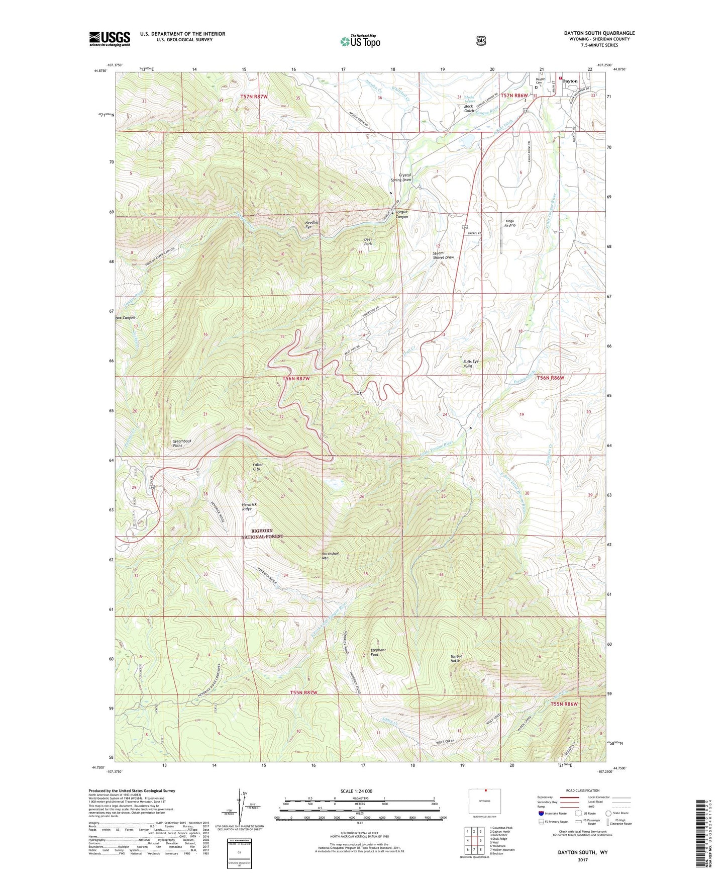
2021 topographic map quadrangle Dayton South in the state of Wyoming. Scale: 1:24000. Based on the newly updated USGS 7.5' US Topo map series, this map is in the following counties: Sheridan. The map contains contour data, water features, and other items you are used to seeing on USGS maps, but also has updated roads and other features. This is the next generation of topographic maps. Printed on high-quality waterproof paper with UV fade-resistant inks.
Quads adjacent to this one:
West: Skull Ridge
Northwest: Columbus Peak
North: Dayton North
Northeast: Ranchester
East: Wolf
Southeast: Beckton
South: Walker Mountain
Southwest: Woodrock
Contains the following named places: Amsden Creek, Big Horn Mountain Mine, Bulls Eye Point, Crystal Spring Draw, Dayton Cemetery, Dayton Volunteer Fire and Rescue Department, Deer Park, East Fork Little Tongue River, Elephant Foot, Fallen City, Frisbie Ditch, Hairpin Turn, Herdrick Ridge, Horseshoe Mountain, Horseshoe Ranch, I X L Ranch, Mock Gulch, Model Geyser, Needles Eye, Pasture Creek, Sand Turn, Sheep Creek, Sheridan County Big Game Winter Range, South Fork Little Tongue River, South Side Ditch, Steam Shovel Draw, Steamboat Point, Tongue Butte, Tongue Canyon, Tongue Canyon Campground, Tongue River Campground, Tongue River High School, Town of Dayton, Trail Creek, Turkey Creek, Whitetail Creek, Xingu Airstrip