MyTopo
Dickinson Park Wyoming US Topo Map
Couldn't load pickup availability
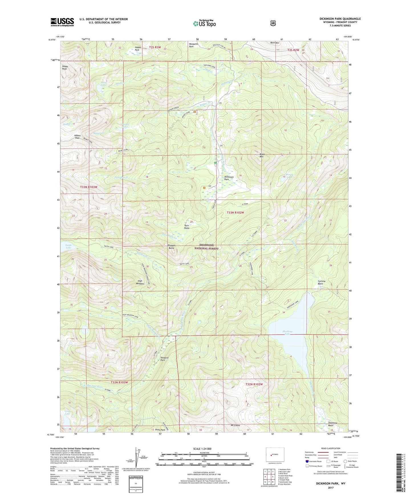
2021 topographic map quadrangle Dickinson Park in the state of Wyoming. Scale: 1:24000. Based on the newly updated USGS 7.5' US Topo map series, this map is in the following counties: Fremont. The map contains contour data, water features, and other items you are used to seeing on USGS maps, but also has updated roads and other features. This is the next generation of topographic maps. Printed on high-quality waterproof paper with UV fade-resistant inks.
Quads adjacent to this one:
West: Lizard Head Peak
Northwest: Washakie Park
North: Moccasin Lake
Northeast: Wind River
East: Mount Arter
Southeast: Cony Mountain
South: Sweetwater Gap
Southwest: Temple Peak
Contains the following named places: Adams Pass, Bald Mountain Area Mine, Beauty Lake, Black Mountain, Cyclone Basin, Dickinson Creek, Dickinson Creek Campground, Dickinson Park, Dickinson Park Guard Station, Dishpan Butte, Funnel Lake, High Meadow, High Meadow Creek, High Meadow Trail, Hobbs Park, Hobbs Peak, Ice Lakes Trail, Long Lake, Mount Chevo, Ranger Creek, Sand Lake, Sandord Park, Shoshone Creek, Shoshone Lake, Shoshone Lake Dam, Smith Lake, Smith Lake Creek, Smith Lake Trail, Twin Parks, Twin Parks Creek