MyTopo
Wind River Wyoming US Topo Map
Couldn't load pickup availability
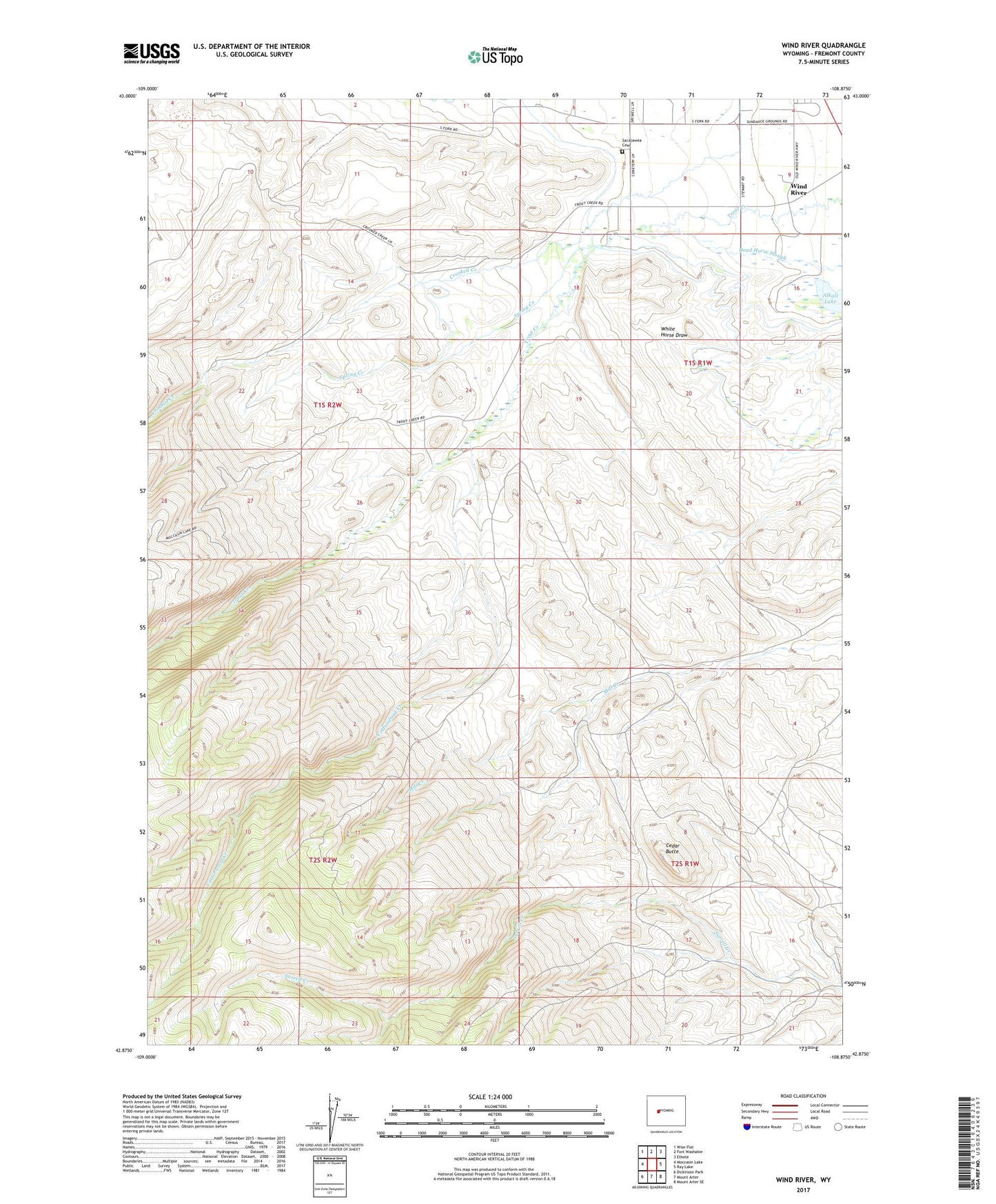
2021 topographic map quadrangle Wind River in the state of Wyoming. Scale: 1:24000. Based on the newly updated USGS 7.5' US Topo map series, this map is in the following counties: Fremont. The map contains contour data, water features, and other items you are used to seeing on USGS maps, but also has updated roads and other features. This is the next generation of topographic maps. Printed on high-quality waterproof paper with UV fade-resistant inks.
Quads adjacent to this one:
West: Moccasin Lake
Northwest: Wise Flat
North: Fort Washakie
Northeast: Ethete
East: Ray Lake
Southeast: Mount Arter SE
South: Mount Arter
Southwest: Dickinson Park
This map covers the same area as the classic USGS quad with code o42108h8.
Contains the following named places: Alkali Lake, Blue Trail, Cedar Butte, Cottonwood Creek, Fort Washakie Underground Reservoir, North Fork Canyon Number One Mine, Roberts Mission, Sacajawea Cemetery, Spring Creek, Wind River, Wind River Mountain Front Number One Mine