MyTopo
Difficulty Wyoming US Topo Map
Couldn't load pickup availability
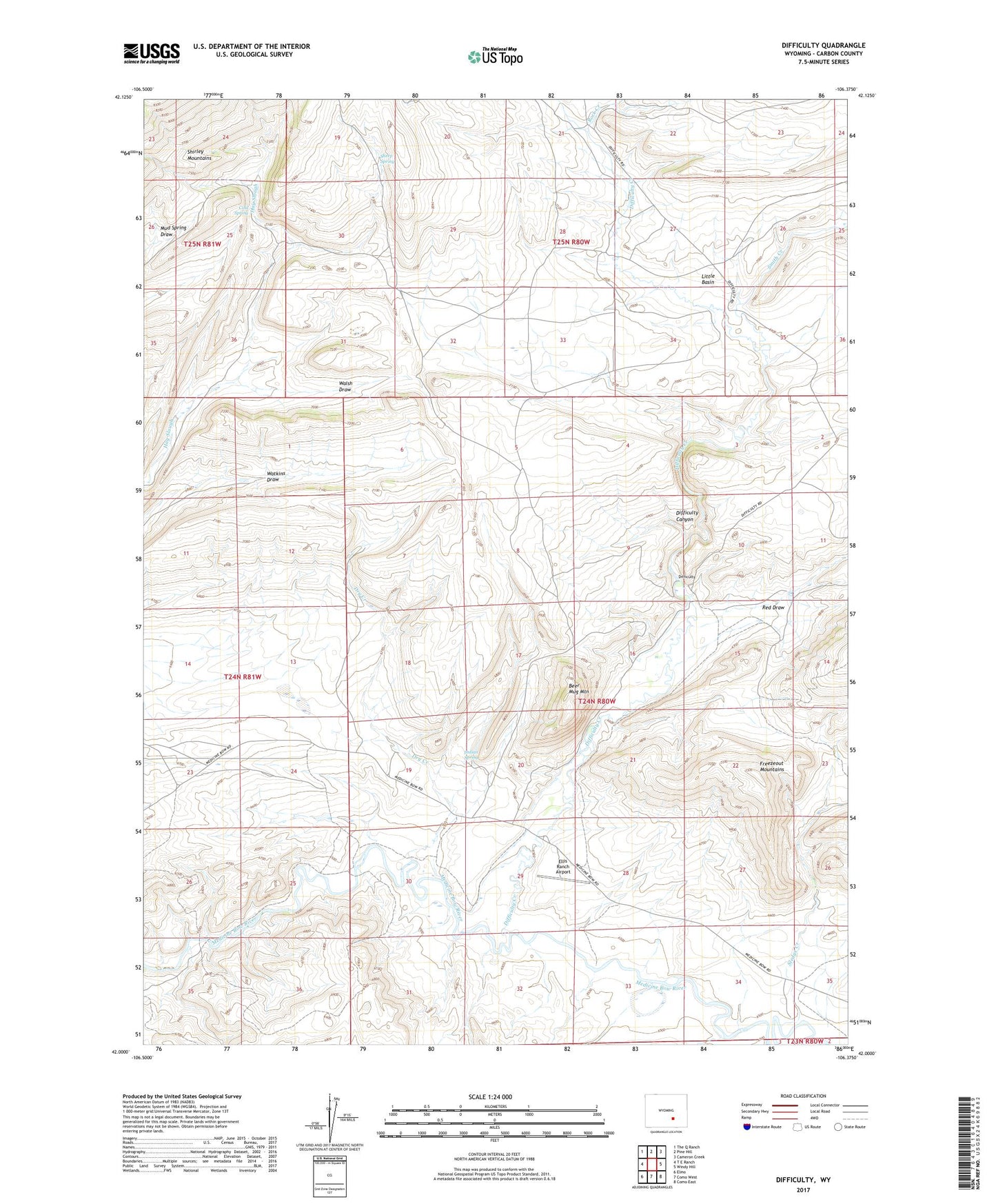
2021 topographic map quadrangle Difficulty in the state of Wyoming. Scale: 1:24000. Based on the newly updated USGS 7.5' US Topo map series, this map is in the following counties: Carbon. The map contains contour data, water features, and other items you are used to seeing on USGS maps, but also has updated roads and other features. This is the next generation of topographic maps. Printed on high-quality waterproof paper with UV fade-resistant inks.
Quads adjacent to this one:
West: T E Ranch
Northwest: The Q Ranch
North: Pine Hill
Northeast: Cameron Creek
East: Windy Hill
Southeast: Como East
South: Como West
Southwest: Elmo
This map covers the same area as the classic USGS quad with code o42106a4.
Contains the following named places: Beer Mug Mountain, Beer Mug Ranch, Cold Spring, Coulter Mine, Difficulty, Difficulty Canyon, Difficulty Creek, Dry Creek, Ellis Ranch, Ellis Ranch Airport, Freezeout Hills Number Four Mine, Freezeout Hills Number Three Mine, Freezeout Mountains, Indian Spring, Little Basin, Paradise, Red Draw, Rock Creek, Schmale Ranch, Sheep Spring, Sledge Creek, Smith Creek, Walsh Draw