MyTopo
Elmo Wyoming US Topo Map
Couldn't load pickup availability
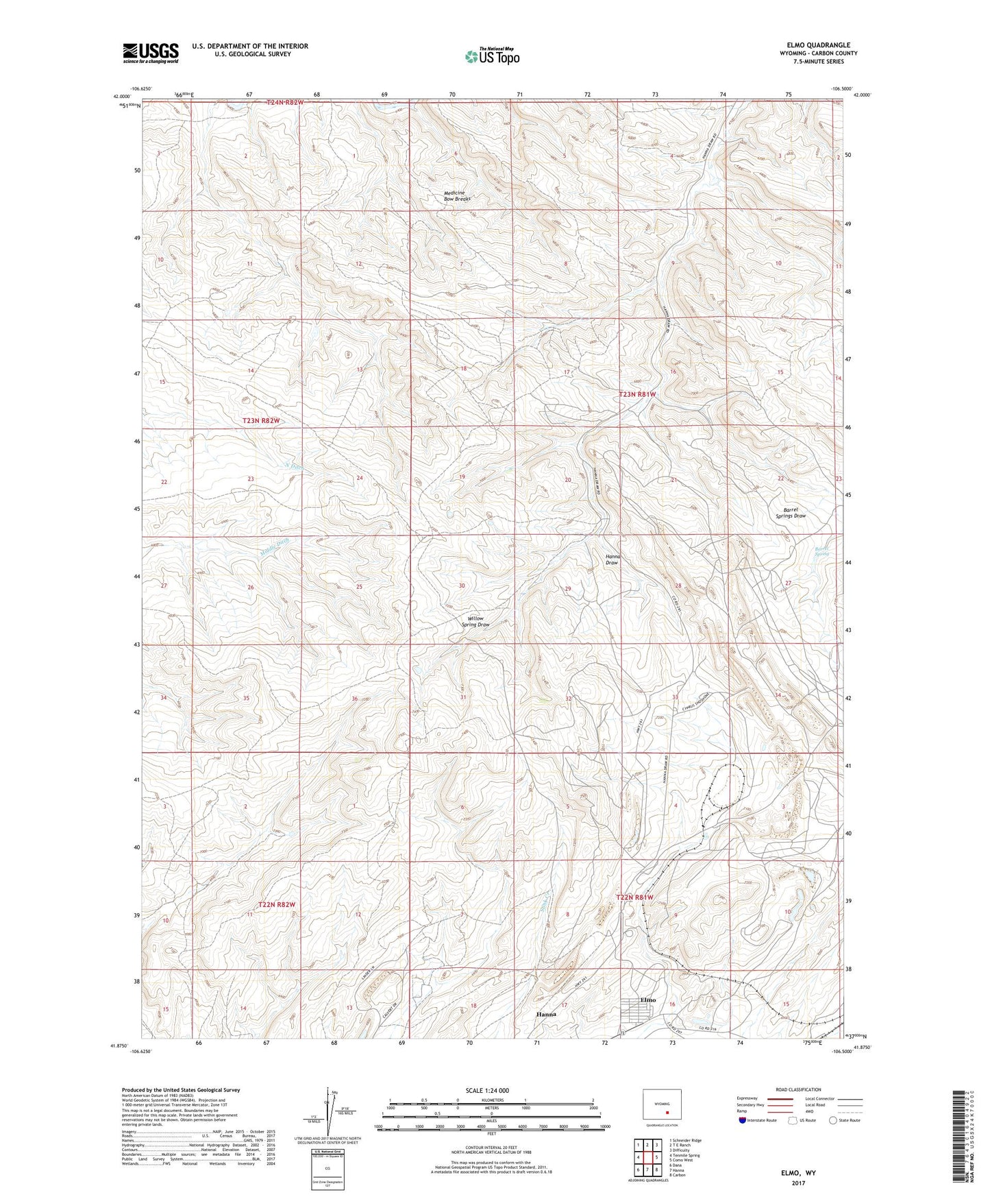
2021 topographic map quadrangle Elmo in the state of Wyoming. Scale: 1:24000. Based on the newly updated USGS 7.5' US Topo map series, this map is in the following counties: Carbon. The map contains contour data, water features, and other items you are used to seeing on USGS maps, but also has updated roads and other features. This is the next generation of topographic maps. Printed on high-quality waterproof paper with UV fade-resistant inks.
Quads adjacent to this one:
West: Tenmile Spring
Northwest: Schneider Ridge
North: T E Ranch
Northeast: Difficulty
East: Como West
Southeast: Carbon
South: Hanna
Southwest: Dana
This map covers the same area as the classic USGS quad with code o41106h5.
Contains the following named places: Antelope Dam, Antelope Reservoir, Barrel Spring, Barrel Springs Draw, Elmo, Elmo Peacock Mine, Hanna and Dravo Mine, Hanna Number One Strip Mine, McMillen Mine, Medicine Bow Breaks, Nugget Mine, Red Mountain Mine, Rosebud Pit Number Eight, Rosebud Pit Number Five, Rosebud Pit Number Three, Rosebud Strip Mine, Seminoe Number Two Mine, Willow Spring Draw