MyTopo
Como West Wyoming US Topo Map
Couldn't load pickup availability
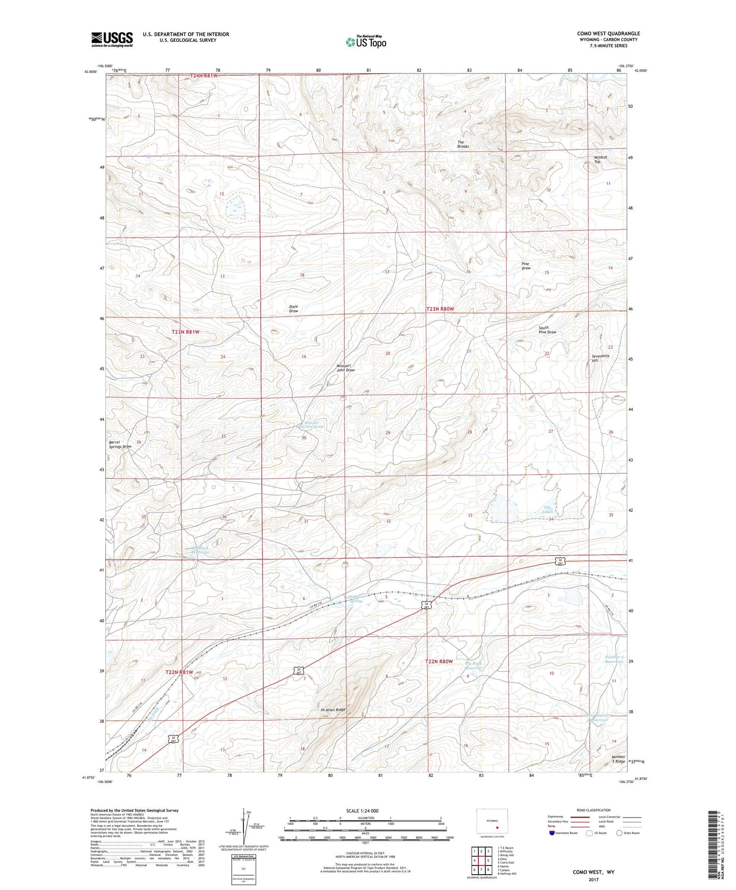
2021 topographic map quadrangle Como West in the state of Wyoming. Scale: 1:24000. Based on the newly updated USGS 7.5' US Topo map series, this map is in the following counties: Carbon. The map contains contour data, water features, and other items you are used to seeing on USGS maps, but also has updated roads and other features. This is the next generation of topographic maps. Printed on high-quality waterproof paper with UV fade-resistant inks.
Quads adjacent to this one:
West: Elmo
Northwest: T E Ranch
North: Difficulty
Northeast: Windy Hill
East: Como East
Southeast: Halfway Hill
South: Carbon
Southwest: Hanna
This map covers the same area as the classic USGS quad with code o41106h4.
Contains the following named places: Big Rock Reservoir, Carbon Number Five Mine, Carbon Number Four Mine, Chace Ranch, Como, Dixie Draw, Hanna Basin Strip Mine, Hanna Division, Hi Allen Ridge, Hi Allen Spring, Missouri John Spring, Missuori John Draw, Number 5 Reservoir, Number 5 Ridge, Ramsey, Rosebud Dam, Rosebud Pit Number Seven, Rosebud Reservoir, Sampo, Sampo Mine, Sevenmile Hill, The Breaks, The Lakes, Upper Number 5 Reservoir, Wildcat Top