MyTopo
T E Ranch Wyoming US Topo Map
Couldn't load pickup availability
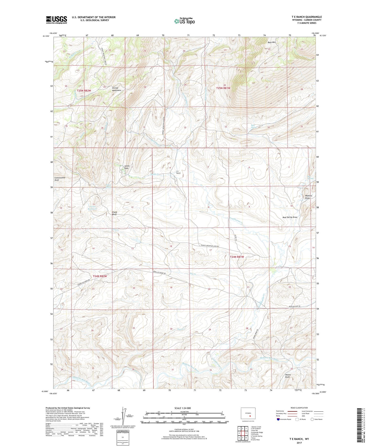
2021 topographic map quadrangle T E Ranch in the state of Wyoming. Scale: 1:24000. Based on the newly updated USGS 7.5' US Topo map series, this map is in the following counties: Carbon. The map contains contour data, water features, and other items you are used to seeing on USGS maps, but also has updated roads and other features. This is the next generation of topographic maps. Printed on high-quality waterproof paper with UV fade-resistant inks.
Quads adjacent to this one:
West: Schneider Ridge
Northwest: Beaver Creek
North: The Q Ranch
Northeast: Pine Hill
East: Difficulty
Southeast: Como West
South: Elmo
Southwest: Tenmile Spring
This map covers the same area as the classic USGS quad with code o42106a5.
Contains the following named places: Bald Knob Mine, Bald Mountain, Bog Springs, Campbell Ranch, Chalk Bluff, Chimney Rock Claims, Cottonwood Creek, Dry Creek, Dry Creek Mine, Hanna Draw, Hay Slough, Maynard Homestead, Mud Spring, Mud Spring Draw, Nelson Ditch, Nelson Spring, Roaring Creek, Rock Crossing Mine, Shirley Mountains, Smith Creek, Smith Park, T E Ranch, Troublesome Creek, Vivian Reservoir, Walgreen Ranch, Walsh Ranch, Watkins Draw, Watkins Ranch