MyTopo
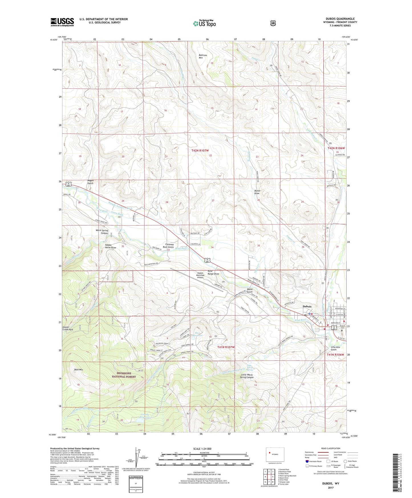
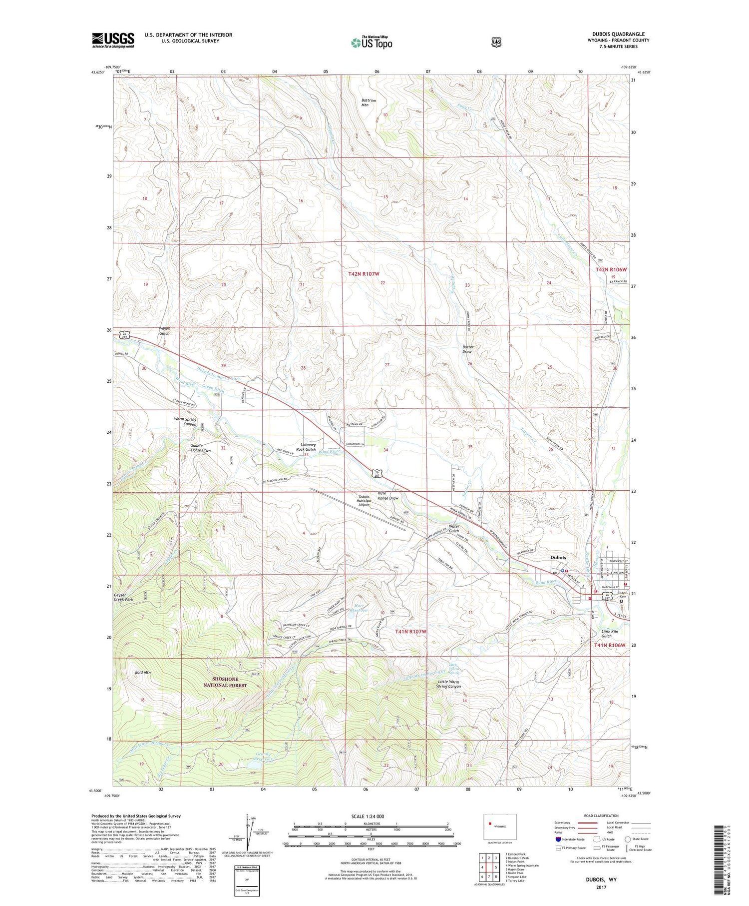
Dubois Wyoming US Topo Map
Couldn't load pickup availability
2021 topographic map quadrangle Dubois in the state of Wyoming. Scale: 1:24000. Based on the newly updated USGS 7.5' US Topo map series, this map is in the following counties: Fremont. The map contains contour data, water features, and other items you are used to seeing on USGS maps, but also has updated roads and other features. This is the next generation of topographic maps. Printed on high-quality waterproof paper with UV fade-resistant inks.
Quads adjacent to this one:
West: Warm Spring Mountain
Northwest: Esmond Park
North: Ramshorn Peak
Northeast: Indian Point
East: Mason Draw
Southeast: Torrey Lake
South: Simpson Lake
Southwest: Union Peak
Contains the following named places: Bachelor Creek, Bald Mountain, Butler Draw, Chimney Rock Gulch, Dubois, Dubois Cemetery, Dubois Division, Dubois High School, Dubois Middle School, Dubois Municipal Airport, Dubois Number One Mine, Dubois Post Office, Dubois School, Dubois Sheriff's Office, Dubois Volunteer Fire Department, Enlargement of Grandy Dam, Fremont County Emergency Medical Services Dubois, Geyser Creek, Geyser Creek Trail, Grandy Reservoir, Green Ditch, Harrison Ranch, Hart Reservoir, Holmes Number 1 Ditch, Horse Creek, Lime Kiln Gulch, Little Warm Spring, Little Warm Spring Canyon, Little Warm Spring Creek, Norton Ditch, Pony Creek, Rifle Range Draw, Saddle Horse Draw, Shipley Ranch, Shoshone National Forest Wind River Ranger District Fire Engine Crew, Spruce Creek, Tappan Creek, Taylor Creek, Town of Dubois, Wagon Gulch, Warm Spring Canyon, Warm Spring Creek, Water Gulch