
MyTopo
Esterbrook Wyoming US Topo Map
Couldn't load pickup availability
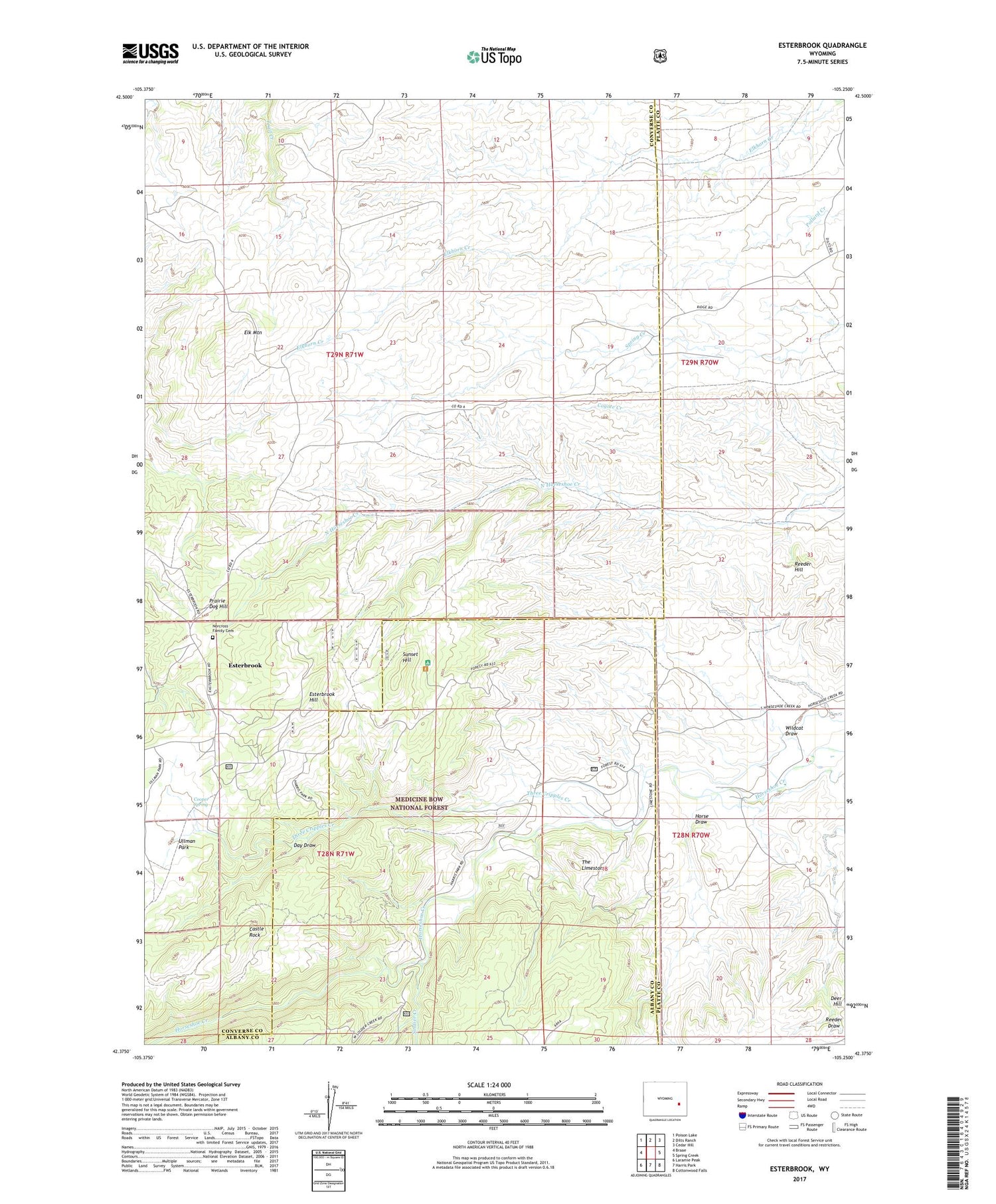
2021 topographic map quadrangle Esterbrook in the state of Wyoming. Scale: 1:24000. Based on the newly updated USGS 7.5' US Topo map series, this map is in the following counties: Converse, Platte, Albany. The map contains contour data, water features, and other items you are used to seeing on USGS maps, but also has updated roads and other features. This is the next generation of topographic maps. Printed on high-quality waterproof paper with UV fade-resistant inks.
Quads adjacent to this one:
West: Braae
Northwest: Poison Lake
North: Dilts Ranch
Northeast: Cedar Hill
East: Spring Creek
Southeast: Cottonwood Falls
South: Harris Park
Southwest: Laramie Peak
Contains the following named places: Castle Rock, Cooper Spring, Day Draw, Elk Mountain, Esterbrook, Esterbrook Campground, Esterbrook Hill, Esterbrook Work Center, Fred Dilts Number 4 Dam, Fred Dilts Reservoir Number 4, Horse Draw, Macfarlane Ranch, Norcross Family Cemetery, Prairie Dog Hill, Reeder Hill, Soldier Creek, Sunset Hill, The Limestone, Three Cripples Creek, Wildcat Draw


