MyTopo
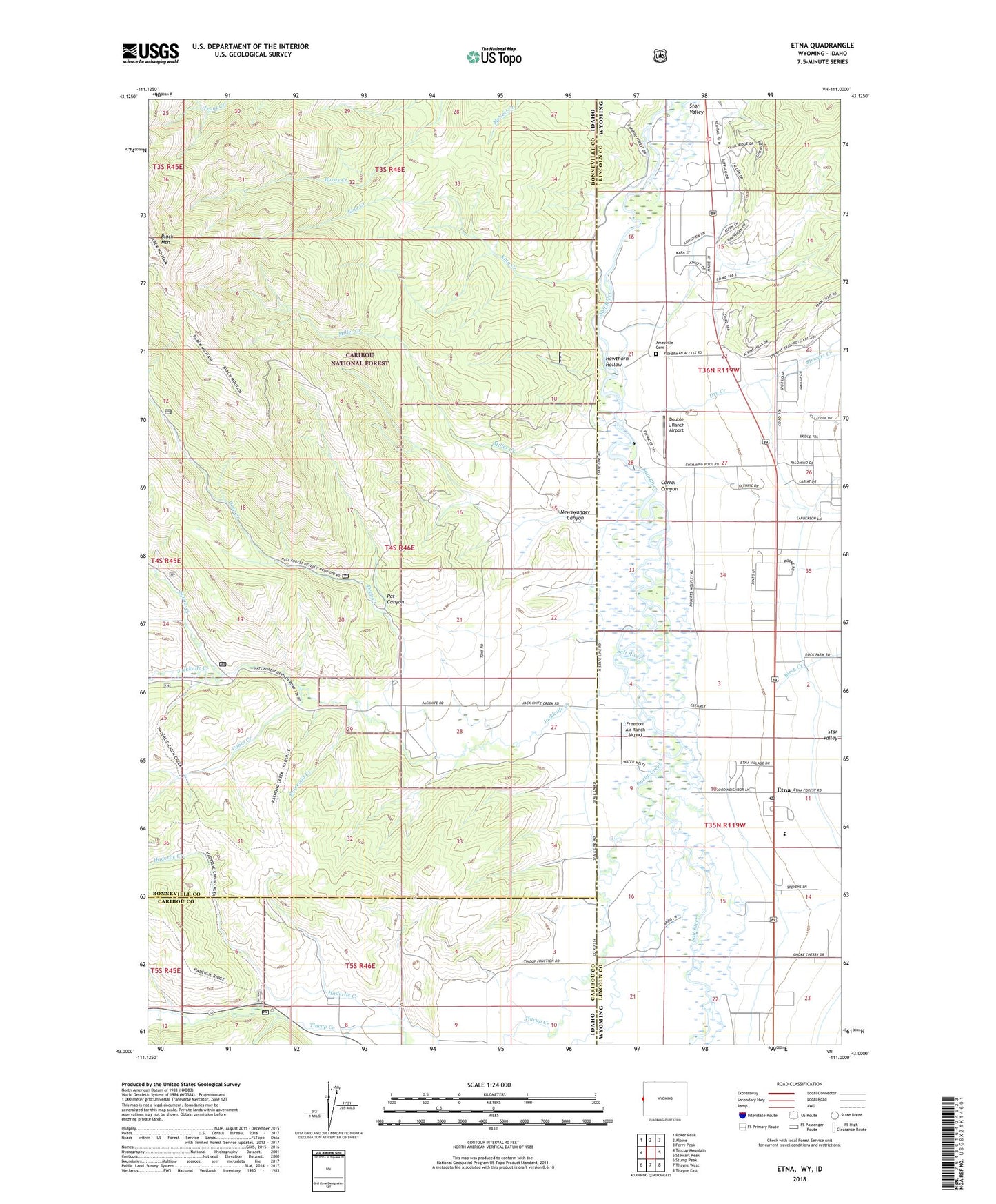
Etna Wyoming US Topo Map
Couldn't load pickup availability
Also explore the Etna Forest Service Topo of this same quad for updated USFS data
2023 topographic map quadrangle Etna in the states of Idaho, Wyoming. Scale: 1:24000. Based on the newly updated USGS 7.5' US Topo map series, this map is in the following counties: Lincoln, Bonneville, Caribou. The map contains contour data, water features, and other items you are used to seeing on USGS maps, but also has updated roads and other features. This is the next generation of topographic maps. Printed on high-quality waterproof paper with UV fade-resistant inks.
Quads adjacent to this one:
West: Tincup Mountain
Northwest: Poker Peak
North: Alpine
Northeast: Ferry Peak
East: Stewart Peak
Southeast: Thayne East
South: Thayne West
Southwest: Stump Peak
This map covers the same area as the classic USGS quad with code o43111a1.
Contains the following named places: Amesville Cemetery, Baker Ditch, Birch Creek, Cabin Creek, Corral Canyon, Deep Creek, Double L Ranch Airport, Dry Creek, Etna, Etna Census Designated Place, Etna Post Office, Freedom Air Ranch Airport, Grouse Creek, Hawthorn Hollow, Jackknife Creek, King Creek, Lee Creek, Metcalf School, Miller Creek, Newswander Canyon, Pat Canyon, Raymond Creek, Squaw Creek, Star Valley, Stewart Creek, Tincup Campground, Tincup Creek