MyTopo
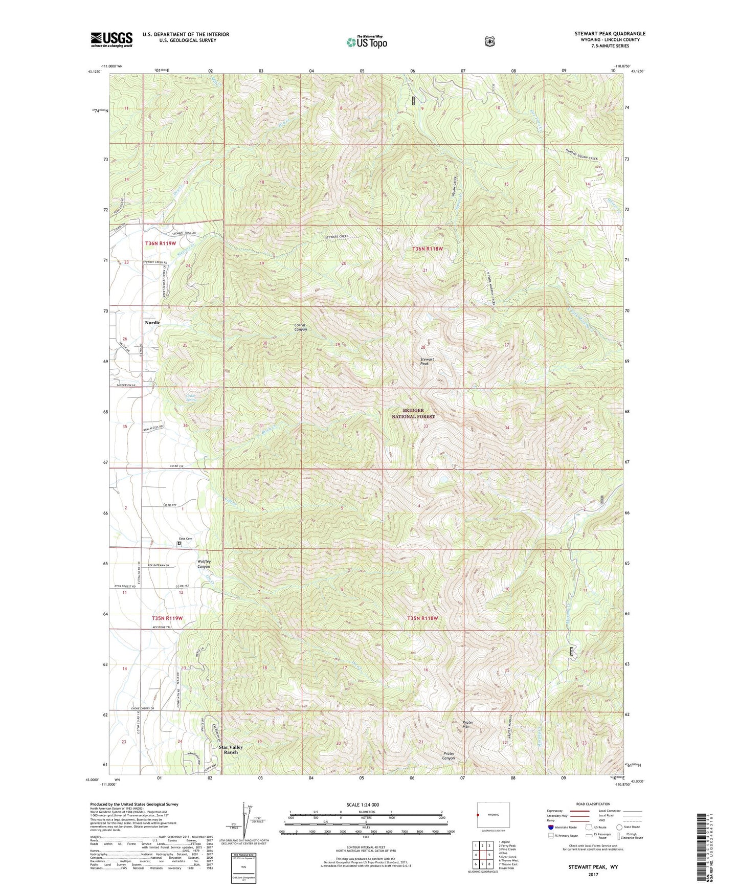
Stewart Peak Wyoming US Topo Map
Couldn't load pickup availability
Also explore the Stewart Peak Forest Service Topo of this same quad for updated USFS data
2023 topographic map quadrangle Stewart Peak in the state of Wyoming. Scale: 1:24000. Based on the newly updated USGS 7.5' US Topo map series, this map is in the following counties: Lincoln. The map contains contour data, water features, and other items you are used to seeing on USGS maps, but also has updated roads and other features. This is the next generation of topographic maps. Printed on high-quality waterproof paper with UV fade-resistant inks.
Quads adjacent to this one:
West: Etna
Northwest: Alpine
North: Ferry Peak
Northeast: Pine Creek
East: Deer Creek
Southeast: Man Peak
South: Thayne East
Southwest: Thayne West
This map covers the same area as the classic USGS quad with code o43110a8.
Contains the following named places: Call Creek, Cedar Spring, Etna Cemetery, Nordic Census Designated Place, Prater Mountain, Stewart Peak, Wolfley Canyon, ZIP Code: 83118