MyTopo
Cow Creek Ranch Wyoming US Topo Map
Couldn't load pickup availability
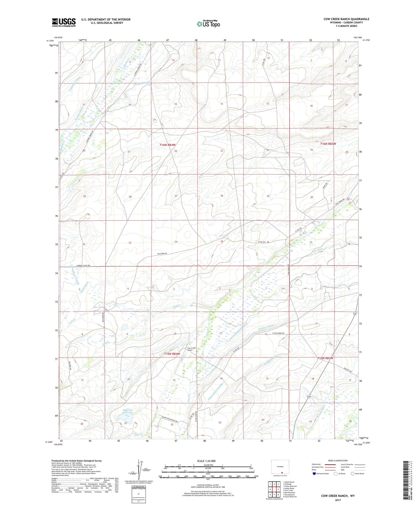
2021 topographic map quadrangle Cow Creek Ranch in the state of Wyoming. Scale: 1:24000. Based on the newly updated USGS 7.5' US Topo map series, this map is in the following counties: Carbon. The map contains contour data, water features, and other items you are used to seeing on USGS maps, but also has updated roads and other features. This is the next generation of topographic maps. Printed on high-quality waterproof paper with UV fade-resistant inks.
Quads adjacent to this one:
West: Indian Rocks
Northwest: Walck Ranch
North: Saratoga
Northeast: Finley Reservoir
East: Cow Creek
Southeast: Gunst Reservoir
South: Encampment
Southwest: Red Mountain
This map covers the same area as the classic USGS quad with code o41106c7.
Contains the following named places: Anderson Dam, Anderson Reservoir, Calf Creek, Centennial Creek, Centennial Ditch, Cow Creek Highland Ditch, Cow Creek Ranch, Evans Ranch, Hill Ranch, Huston Ranch, Low Ditch, Mcmicken Ditch, Nelson Ditch, Newport Ditch, Old Spring Creek Ditch, Otto Creek, Ridge Ditch, Saratoga Division, Silver Spur Ranch, Tail Creek, Teddy Creek, Trowbridge Ranch, Walck Ditch, Waldron Ditch, Willford Ranch, Willow Ditch, Wolford Ditch, ZIP Code: 82331