MyTopo
Ryan Park Wyoming US Topo Map
Couldn't load pickup availability
Also explore the Ryan Park Forest Service Topo of this same quad for updated USFS data
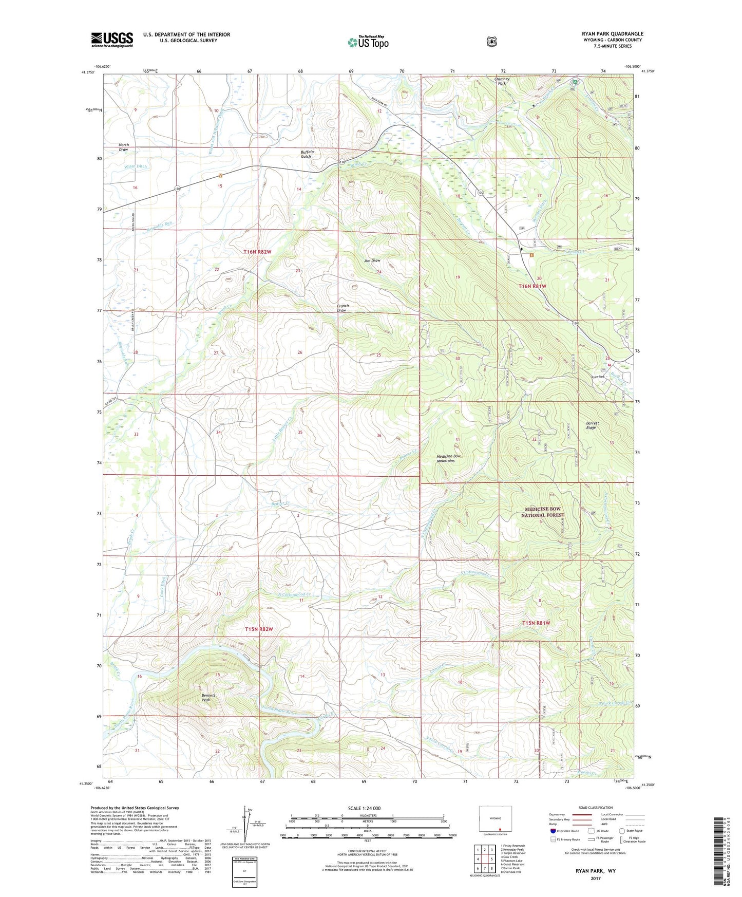
2021 topographic map quadrangle Ryan Park in the state of Wyoming. Scale: 1:24000. Based on the newly updated USGS 7.5' US Topo map series, this map is in the following counties: Carbon. The map contains contour data, water features, and other items you are used to seeing on USGS maps, but also has updated roads and other features. This is the next generation of topographic maps. Printed on high-quality waterproof paper with UV fade-resistant inks.
Quads adjacent to this one:
West: Cow Creek
Northwest: Finley Reservoir
North: Kennaday Peak
Northeast: Turpin Reservoir
East: Phantom Lake
Southeast: Overlook Hill
South: Barcus Peak
Southwest: Gunst Reservoir
This map covers the same area as the classic USGS quad with code o41106c5.
Contains the following named places: Barrett Creek, Beaver Creek, Bennett Peak, Brush Creek, Brush Creek Ranch, Brush Creek Ranger Station, Brush Creek School, Buffalo Gulch, Cabin Camp, Chimney Park, Condict Ranch, Condict Slough, Cook Ditch, Corral Creek, Dewey Mine, Francis Draw, Jim Draw, Lincoln Creek, Lincoln Park, Little Beaver Creek, Medicine Bow Lodge, Moores Creek, Mullison Creek, North Brush Creek, North Cottonwood Creek, Ryan Park, Ryan Park Ski Course, Ryan Park Volunteer Fire Department, South Brush Creek, South Cottonwood Creek, South Fork Corral Creek, Stewart Ditch, Stump Hollow, Tenmile, Uihlein Creek, Wiant and Highline Ditch, Wiant Ditch