MyTopo
Fort Washakie Wyoming US Topo Map
Couldn't load pickup availability
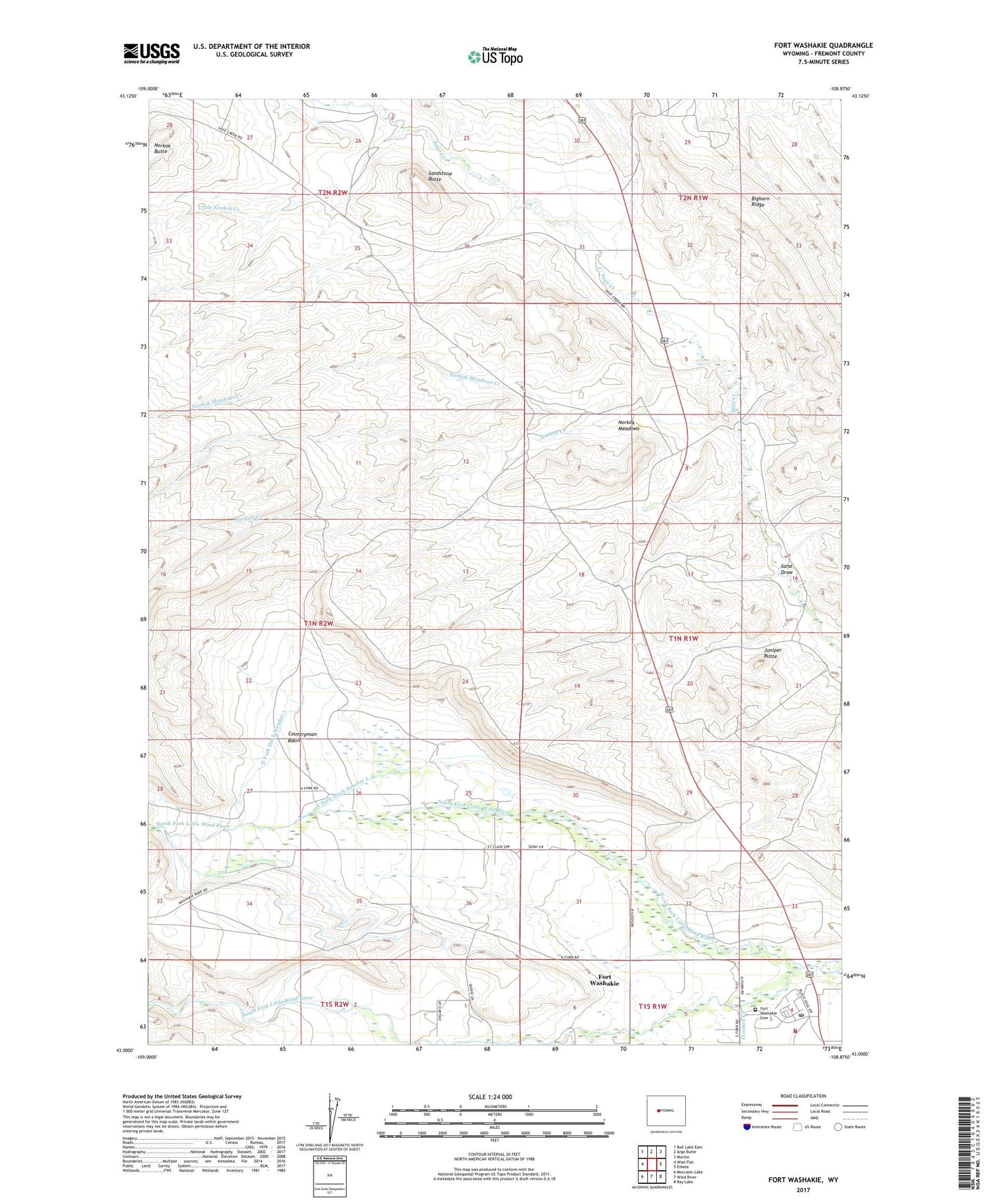
2021 topographic map quadrangle Fort Washakie in the state of Wyoming. Scale: 1:24000. Based on the newly updated USGS 7.5' US Topo map series, this map is in the following counties: Fremont. The map contains contour data, water features, and other items you are used to seeing on USGS maps, but also has updated roads and other features. This is the next generation of topographic maps. Printed on high-quality waterproof paper with UV fade-resistant inks.
Quads adjacent to this one:
West: Wise Flat
Northwest: Bull Lake East
North: Argo Butte
Northeast: Morton
East: Ethete
Southeast: Ray Lake
South: Wind River
Southwest: Moccasin Lake
This map covers the same area as the classic USGS quad with code o43108a8.
Contains the following named places: Countryman Basin, Countryman School, Crooked Creek, Fort Washakie, Fort Washakie Census Designated Place, Fort Washakie Post Office, Fremont County Fire Protection District Battalion 12 Fort Washakie Fire Department, Juniper Butte, Little Norkok Creek, Morning Star Manor Hospital, Norkok Butte, Norkok Creek, Norkok Meadows, Norkok Meadows Creek, North Fork Ditch Number 1, North Fork Ditch Number 2, North Fork Ditch Number 5, North Fork Diversion Canal, North Fork Little Wind River, Sage Creek Number One Mine, Sage Creek Number Three Mine, Sage Creek Number Two Mine, Sand Draw, Sandstone Butte, South Fork Little Wind River, Washakie Cemetery, ZIP Code: 82514