MyTopo
Kaycee NE Wyoming US Topo Map
Couldn't load pickup availability
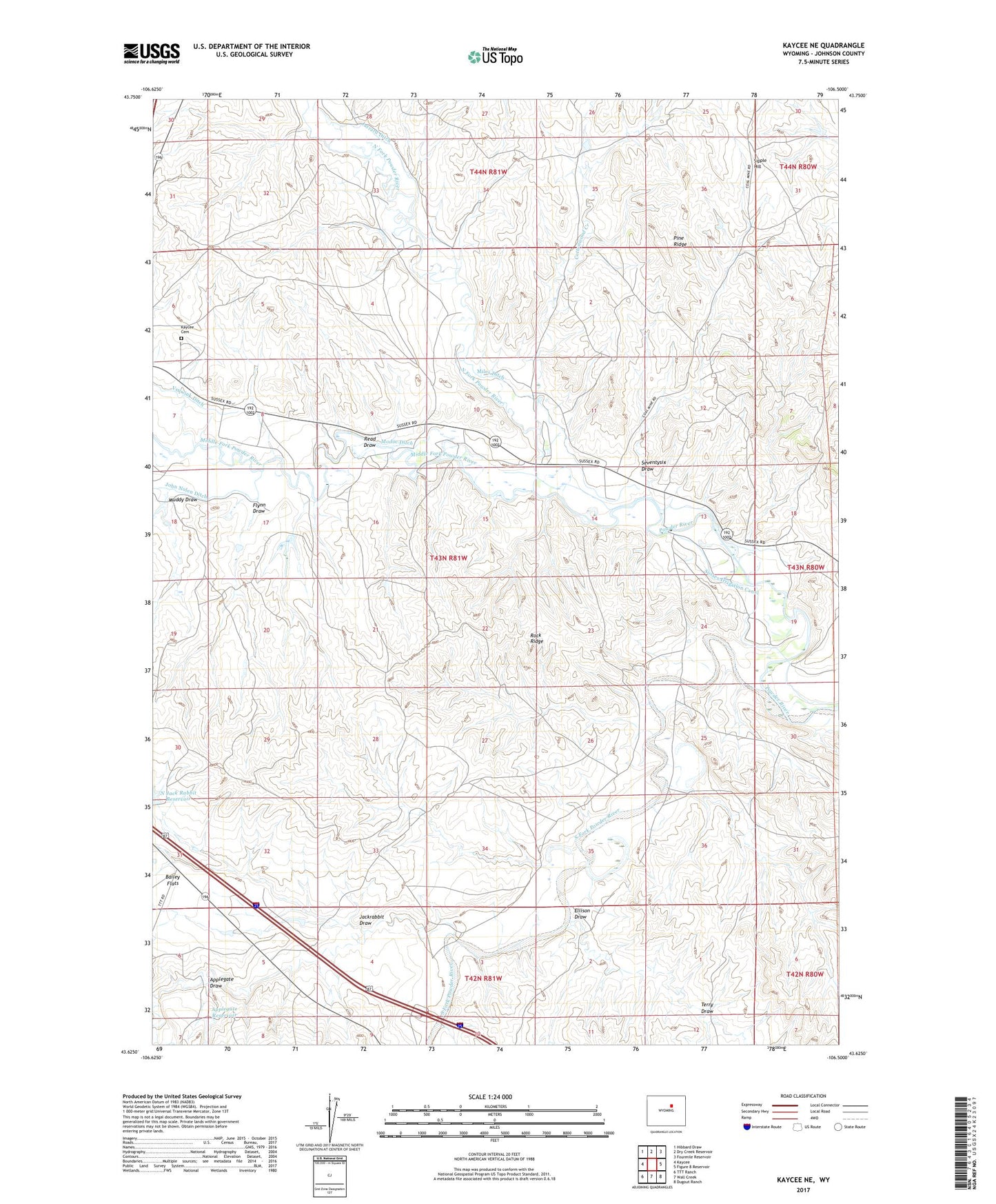
2021 topographic map quadrangle Kaycee NE in the state of Wyoming. Scale: 1:24000. Based on the newly updated USGS 7.5' US Topo map series, this map is in the following counties: Johnson. The map contains contour data, water features, and other items you are used to seeing on USGS maps, but also has updated roads and other features. This is the next generation of topographic maps. Printed on high-quality waterproof paper with UV fade-resistant inks.
Quads adjacent to this one:
West: Kaycee
Northwest: Hibbard Draw
North: Dry Creek Reservoir
Northeast: Fourmile Reservoir
East: Figure 8 Reservoir
Southeast: Dugout Ranch
South: Wall Creek
Southwest: TTT Ranch
Contains the following named places: Applegate Dam, Applegate Draw, Applegate Reservoir, Babion Mine, Bunning Mine, Bybee Mines, Christensen Mine, Christensen Ranch, Christenson Mine, Cottonwood Creek, D Ranch, Ellison Draw, Elm Ranch, Flynn Draw, Flynn Ranch, Jackrabbit Draw, Jarrard Ditch, Jarrard Extension Mine, Jarrard Ranch, Jarrard Rock Pile Mine, John Nolen Ditch, Kaycee Cemetery, Middle Fork Powder River, Miles Ditch, Modoc Ditch, Muddy Draw, Murphy Creek, N Jack Rabbit Dam, N Jack Rabbit Reservoir, Newland Ditch, North Fork Powder River, Read Draw, Rock Ridge, Schiffer Mine, Seventysix Draw, Sipple and Smith Mine, Sipple Hill, Smith Ranch, South Fork Powder River, Sutton School, Terry Draw, Ullery Mine, ZIP Code: 82639