MyTopo
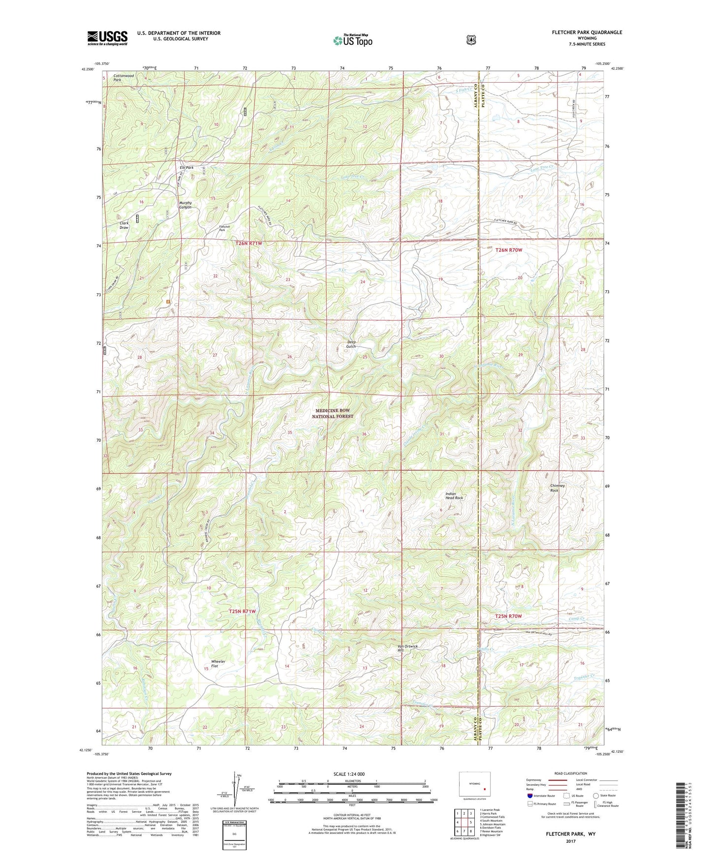
Fletcher Park Wyoming US Topo Map
Couldn't load pickup availability
Also explore the Fletcher Park Forest Service Topo of this same quad for updated USFS data
2021 topographic map quadrangle Fletcher Park in the state of Wyoming. Scale: 1:24000. Based on the newly updated USGS 7.5' US Topo map series, this map is in the following counties: Albany, Platte. The map contains contour data, water features, and other items you are used to seeing on USGS maps, but also has updated roads and other features. This is the next generation of topographic maps. Printed on high-quality waterproof paper with UV fade-resistant inks.
Quads adjacent to this one:
West: South Mountain
Northwest: Laramie Peak
North: Harris Park
Northeast: Cottonwood Falls
East: Johnson Mountain
Southeast: Hightower SW
South: Reese Mountain
Southwest: Davidson Flats
This map covers the same area as the classic USGS quad with code o42105b3.
Contains the following named places: Big Chief Mica Mine, Brandel Creek, Camp Grace, Chimney Rock, Claude Irvine Creek, Deep Gulch, Dixie Queen Claim, Elk Park, Fletcher Park, Hanks Sawmill, Indian Head Rock, Owen Creek, Owen Creek Area Mine, Rainbow Inn, Robinson Creek, South Creek, Van Ortwick Hill, Wheeler Flat