MyTopo
Mount Arter SE Wyoming US Topo Map
Couldn't load pickup availability
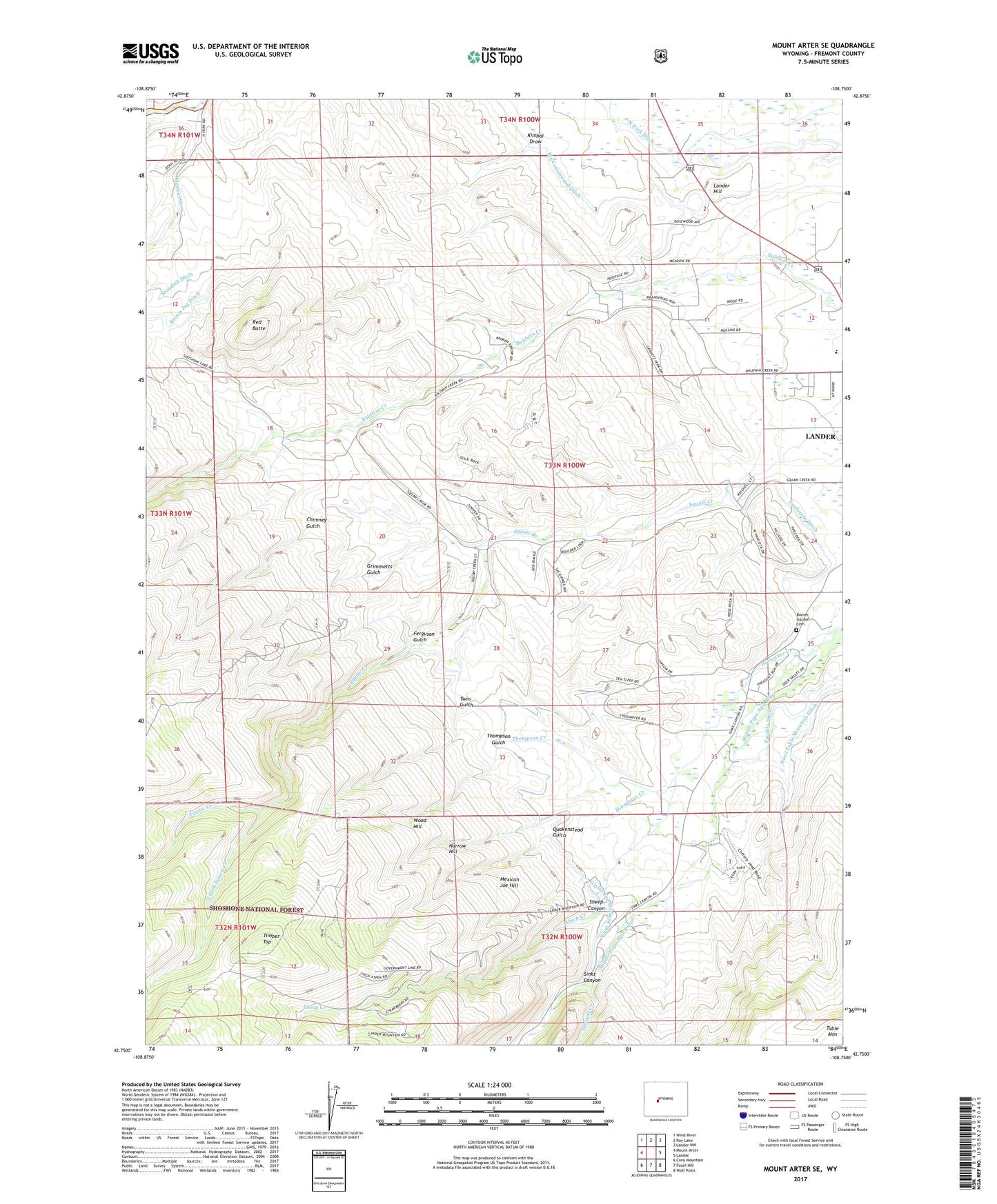
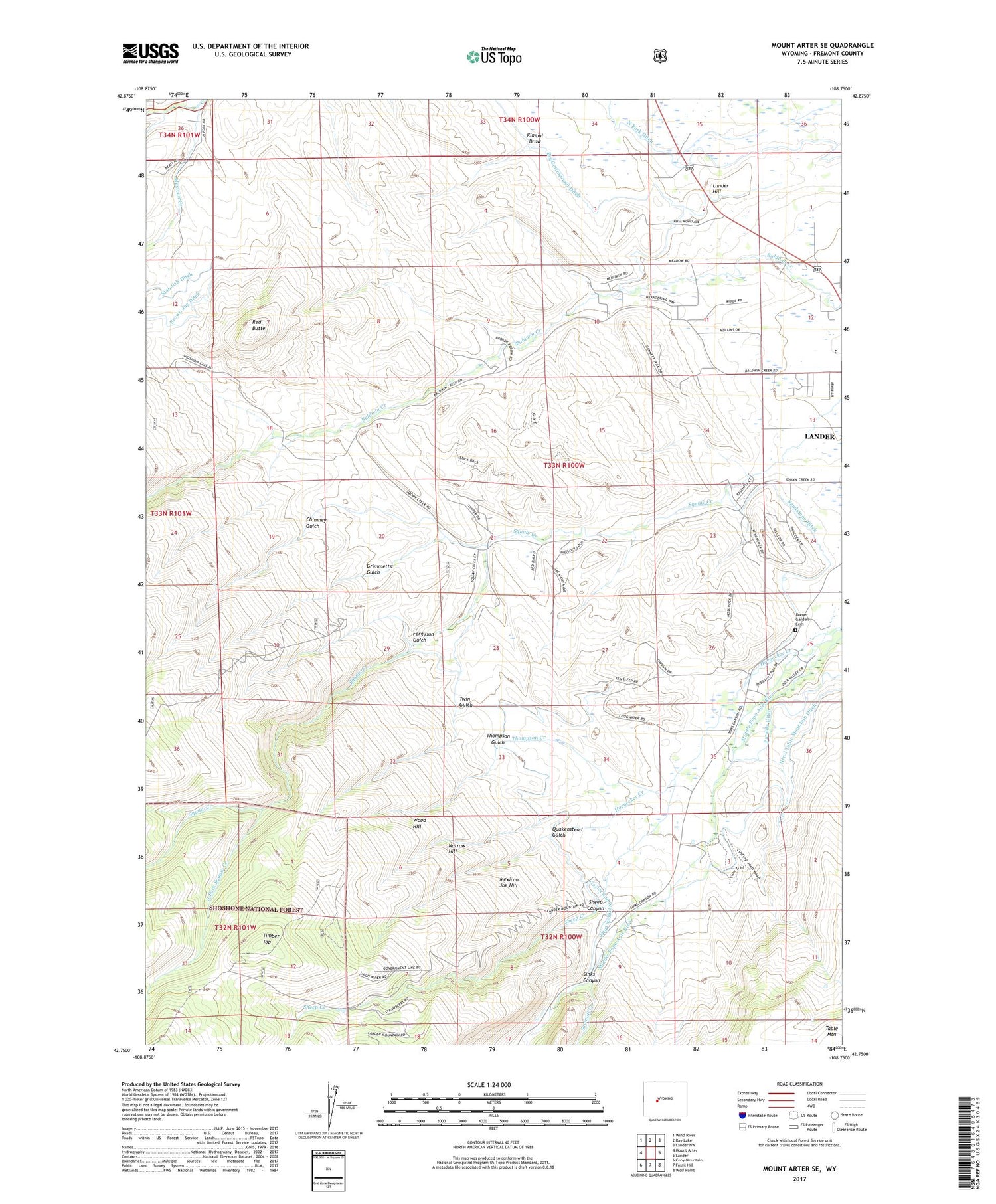
2021 topographic map quadrangle Mount Arter SE in the state of Wyoming. Scale: 1:24000. Based on the newly updated USGS 7.5' US Topo map series, this map is in the following counties: Fremont. The map contains contour data, water features, and other items you are used to seeing on USGS maps, but also has updated roads and other features. This is the next generation of topographic maps. Printed on high-quality waterproof paper with UV fade-resistant inks.
Quads adjacent to this one:
West: Mount Arter
Northwest: Wind River
North: Ray Lake
Northeast: Lander NW
East: Lander
Southeast: Wolf Point
South: Fossil Hill
Southwest: Cony Mountain
Contains the following named places: Baldwin Creek Mine, Baldwin Creek School, Big Cottonwood Ditch, Borner Garden Cemetery, Borner Garden School, Chimney Gulch, City of Lander, Ferguson Gulch, Gaylor and Warnock Ditch, Grimmetts Gulch, Hornecker Ranch Mine, KDLY-FM (Lander), Kimbal Draw, Lander Area Number Two Mine, Lander Hill, Lander Valley High School, Mexican Creek, Mexican Joe Hill, Narrow Hill, North Fork Ditch, Quakenstead Gulch, Red Butte, Sandstone Ditch, Sawmill Creek, Sheep Canyon, Sheep Creek, Sinks Canyon, Sinks Canyon Mine, South Fork Squaw Creek, Squaw Creek Mine, Standish Ditch, Thompson Creek, Thompson Creek Mine, Thompson Gulch, Timber Top, Twin Gulch, Wood Hill