MyTopo
Seminoe Dam NE Wyoming US Topo Map
Couldn't load pickup availability
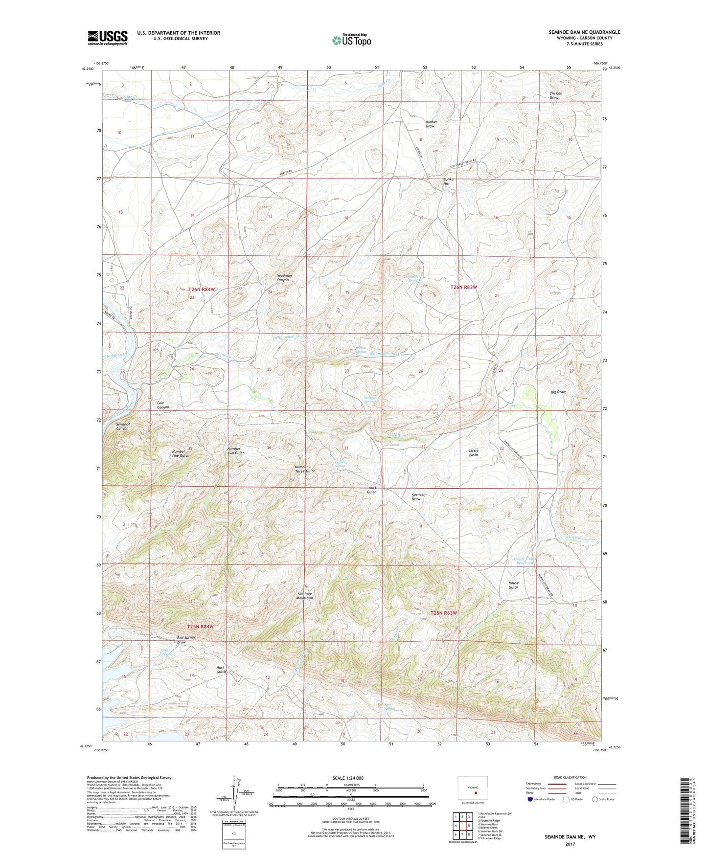
2021 topographic map quadrangle Seminoe Dam NE in the state of Wyoming. Scale: 1:24000. Based on the newly updated USGS 7.5' US Topo map series, this map is in the following counties: Carbon. The map contains contour data, water features, and other items you are used to seeing on USGS maps, but also has updated roads and other features. This is the next generation of topographic maps. Printed on high-quality waterproof paper with UV fade-resistant inks.
Quads adjacent to this one:
West: Seminoe Dam
Northwest: Pathfinder Reservoir SW
North: Leo
Northeast: Fourmile Ridge
East: Beaver Creek
Southeast: Schneider Ridge
South: Seminoe Dam SE
Southwest: Seminoe Dam SW
This map covers the same area as the classic USGS quad with code o42106b7.
Contains the following named places: Big Draw, Black Canyon Ranch, Bunker Hill, Cottonwood Creek, Cow Canyon, Deadman Canyon, Dry Lake, Hamilton Creek, House Gulch, House Gulch Reservoir, Hurt Gulch, Indian Spring, Iron Springs Creek, Kortes Dam Camp, Lost Creek, Lost Creek Ranch, Lost Creek School, Nine Bar W Ranch, Number One Gulch, Number Three Gulch, Number Two Gulch, Red Spring, Red Spring Draw, Sage Creek Clubhouse, Seminoe Canyon, Seminoe Mountains, Shirley Mountains Area Mine, Sips Spring, Spencer Draw, Threemile Spring, Vivian Ranch, Wildcat Springs, Willow Springs, Willow Springs Creek