MyTopo
Piedmont Reservoir Wyoming US Topo Map
Couldn't load pickup availability
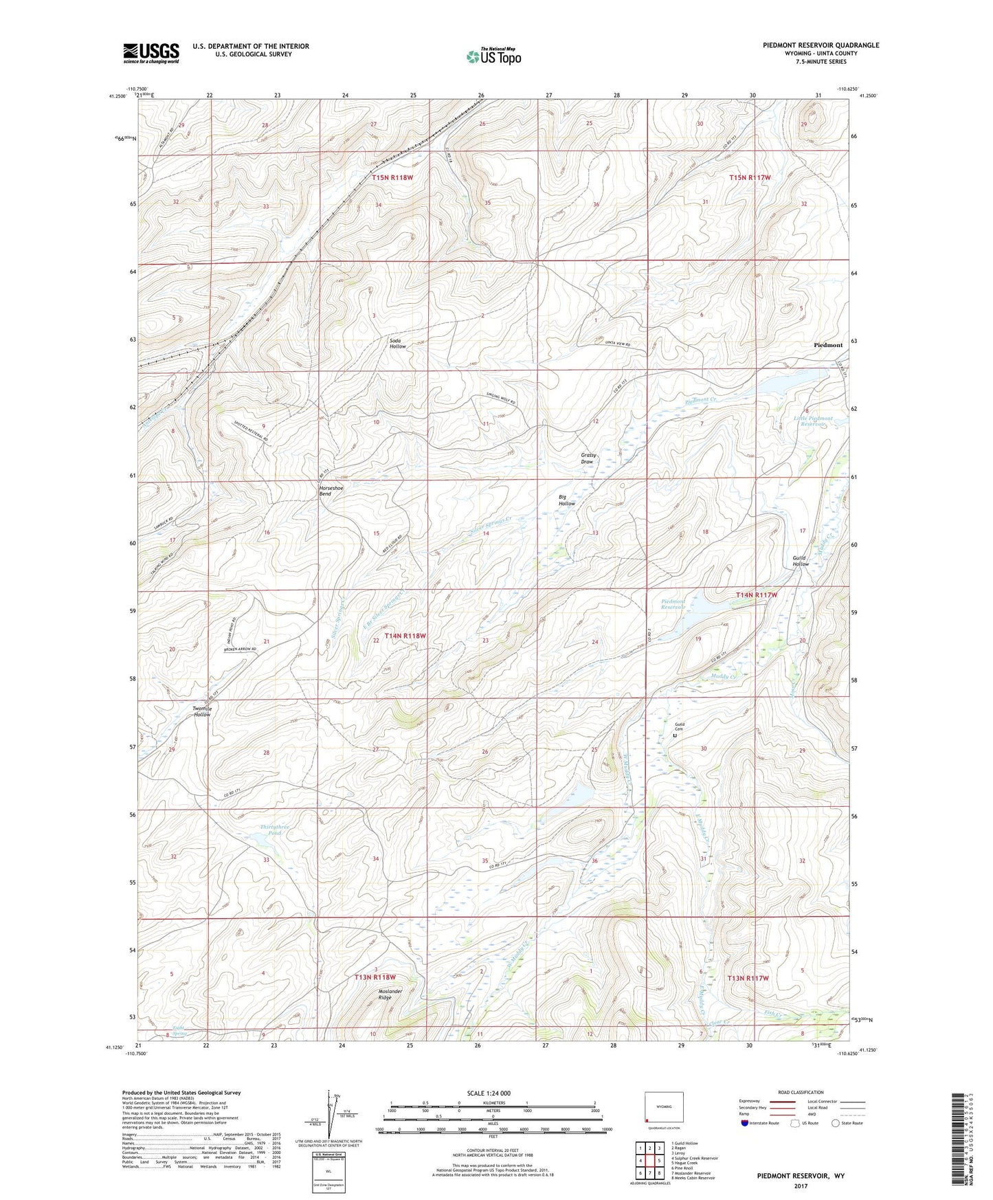
2021 topographic map quadrangle Piedmont Reservoir in the state of Wyoming. Scale: 1:24000. Based on the newly updated USGS 7.5' US Topo map series, this map is in the following counties: Uinta. The map contains contour data, water features, and other items you are used to seeing on USGS maps, but also has updated roads and other features. This is the next generation of topographic maps. Printed on high-quality waterproof paper with UV fade-resistant inks.
Quads adjacent to this one:
West: Sulphur Creek Reservoir
Northwest: Guild Hollow
North: Ragan
Northeast: Leroy
East: Hague Creek
Southeast: Meeks Cabin Reservoir
South: Moslander Reservoir
Southwest: Pine Knoll
Contains the following named places: Big Hollow, Byrne Dam, Byrne Reservoir, Carter Mine, Clear Creek, East Branch Silver Springs Creek, East Muddy Creek, Eight Spring, Fish Creek, Grassy Draw, Guild and Dean Dam, Guild and Dean Reservoir, Guild Cemetery, Guild Dam, Guild Hollow, Guild Reservoir, Horseshoe Bend, Little Peidmont Dam, Little Piedmont Reservoir, Moslander Ridge, Moss Creek, Outlet Cross Ditch, Piedmont, Piedmont Dam, Piedmont Reservoir, Silver Springs Creek, Spring Valley Mine, Thirtythree Pond, Twomile Hollow, West Muddy Creek