MyTopo
Powder River Pass Wyoming US Topo Map
Couldn't load pickup availability
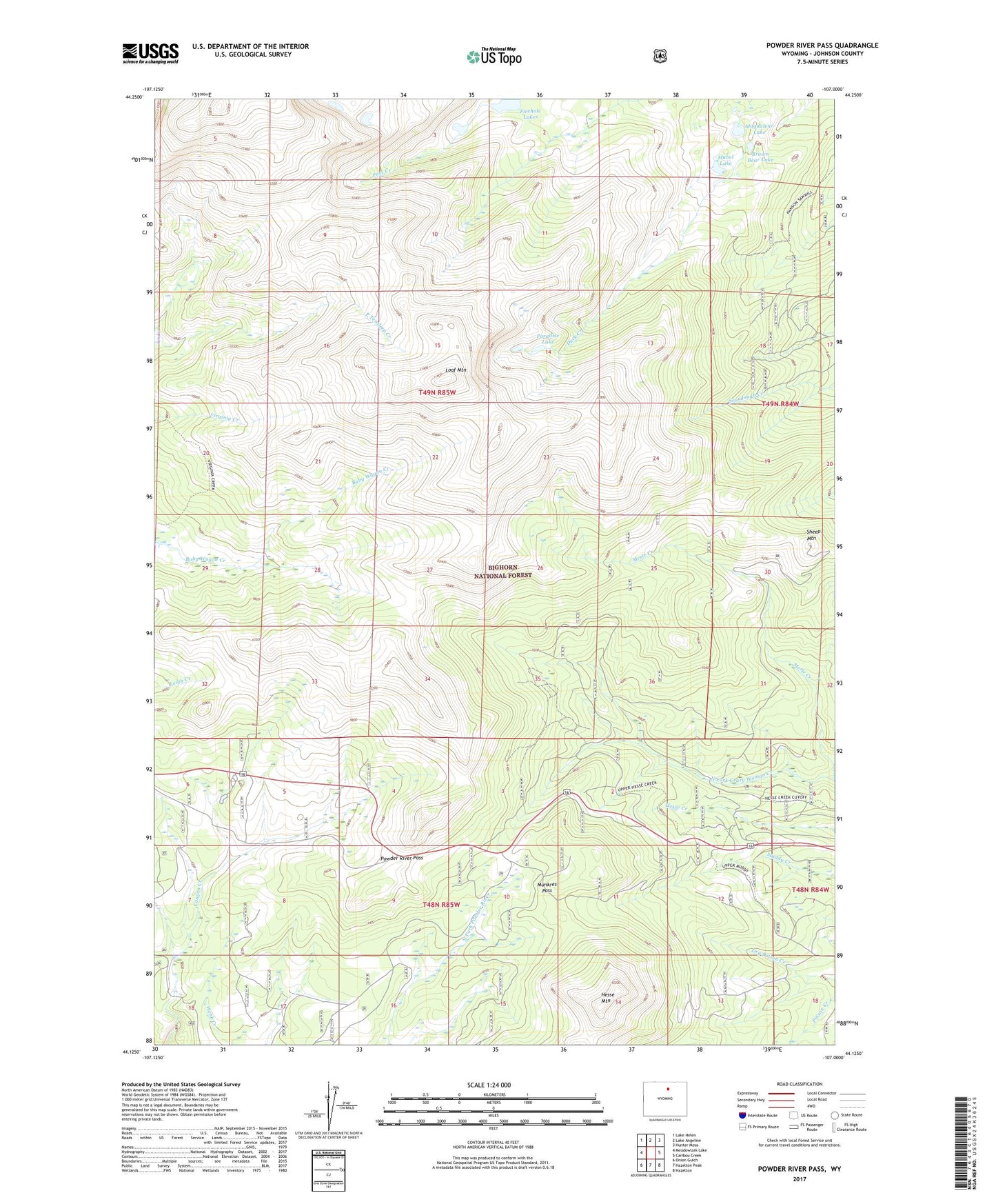
2021 topographic map quadrangle Powder River Pass in the state of Wyoming. Scale: 1:24000. Based on the newly updated USGS 7.5' US Topo map series, this map is in the following counties: Johnson. The map contains contour data, water features, and other items you are used to seeing on USGS maps, but also has updated roads and other features. This is the next generation of topographic maps. Printed on high-quality waterproof paper with UV fade-resistant inks.
Quads adjacent to this one:
West: Meadowlark Lake
Northwest: Lake Helen
North: Lake Angeline
Northeast: Hunter Mesa
East: Caribou Creek
Southeast: Hazelton
South: Hazelton Peak
Southwest: Onion Gulch
Contains the following named places: Brown Bear Lake, Firehole Lakes, Hesse Mountain, Leigh Creek Trailor Dump Station, Loaf Mountain, Mabel Lake, Magdalene Lake, Munkres Pass, Paradise Lake, Powder River Pass, Sheep Mountain