MyTopo
Centennial Wyoming US Topo Map
Couldn't load pickup availability
Also explore the Centennial Forest Service Topo of this same quad for updated USFS data
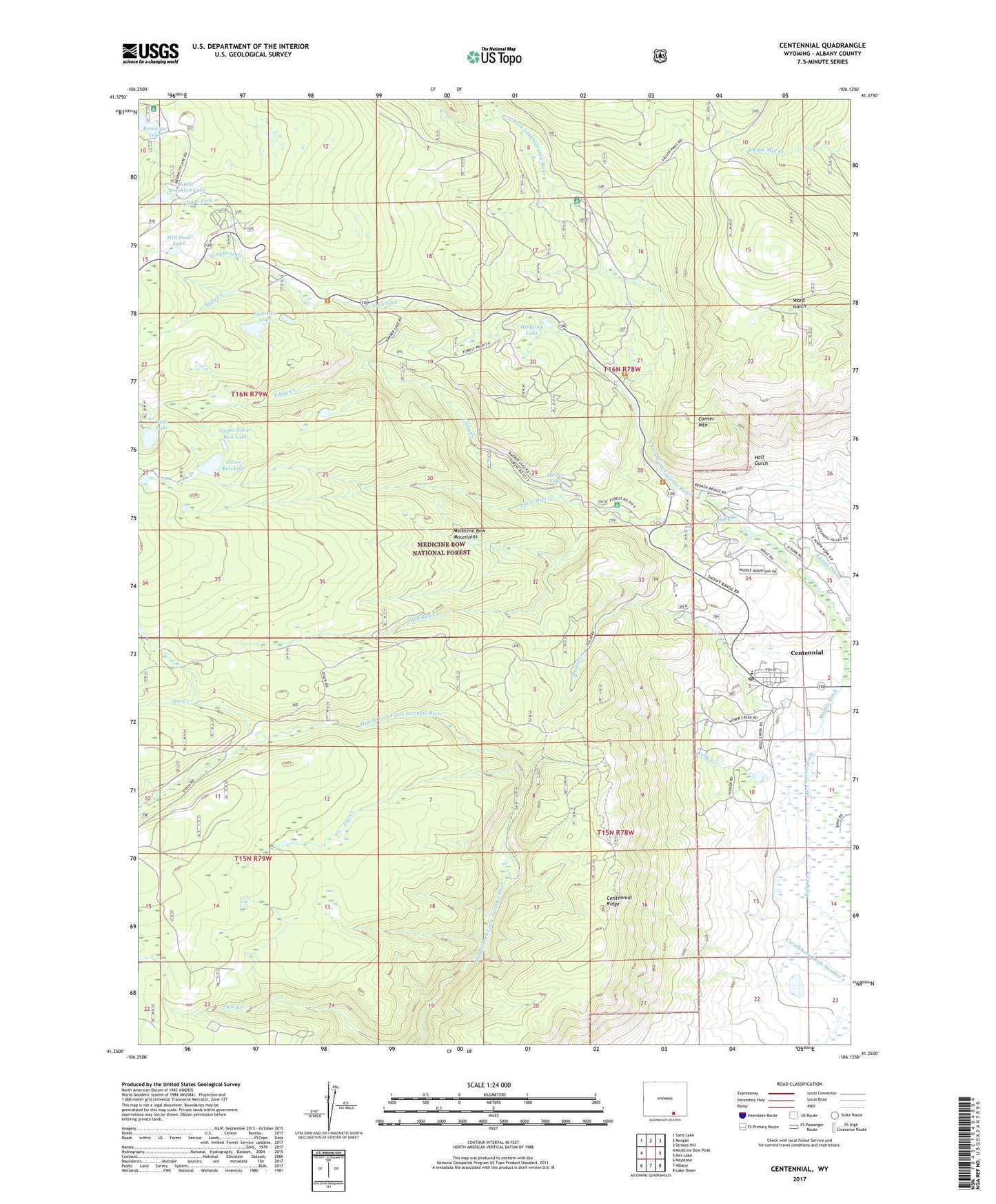
2021 topographic map quadrangle Centennial in the state of Wyoming. Scale: 1:24000. Based on the newly updated USGS 7.5' US Topo map series, this map is in the following counties: Albany. The map contains contour data, water features, and other items you are used to seeing on USGS maps, but also has updated roads and other features. This is the next generation of topographic maps. Printed on high-quality waterproof paper with UV fade-resistant inks.
Quads adjacent to this one:
West: Medicine Bow Peak
Northwest: Sand Lake
North: Morgan
Northeast: Strouss Hill
East: Rex Lake
Southeast: Lake Owen
South: Albany
Southwest: Keystone
This map covers the same area as the classic USGS quad with code o41106c2.
Contains the following named places: Adams Ditch, Barber Lake, Barber Lake Picnic Ground, Bear Lake, Brooklyn Lake Campground, Brooklyn Lake Guard Station, Camp Creek, Centennial, Centennial Census Designated Place, Centennial Mine, Centennial Post Office, Centennial Ranger Station, Centennial Ridge, Centennial Ridge Mine, Centennial School, Christensen Ditch Number 2, Cliff Mine, Columbine Mine, Corner Mountain, Domick Ditch, Empire Mine, Fall Creek, Gold Run Creek, Hall Gulch, Hanging Lake, Independence Mine, Jim Creek, Kentucky Derby Area Mine, Libby Creek, Libby Creek Mine, Libby Creek Picnic Ground, Little Brooklyn Lake, Markle Ditch, Medicine Bow Ski Area, Mill Pond Lake, Mullen Creek, Nash Fork, Nash Fork Picnic Ground, North Fork Campground, Old Channel Ditch, Open Air Chapel, Percy Park, Platinum City Mine, Queen Mine, Sally Creek, Silver Run Creek, Silver Run Lake, Snowy Range Lodge, Snowy Range Natural Area, Swastika Lake, Telephone Creek, University of Wyoming Camp, University of Wyoming Science Camp, Upper Nash Fork Campground, Upper Silver Run Lake, Utopia Mine, Webbers Mill, ZIP Code: 82055