MyTopo
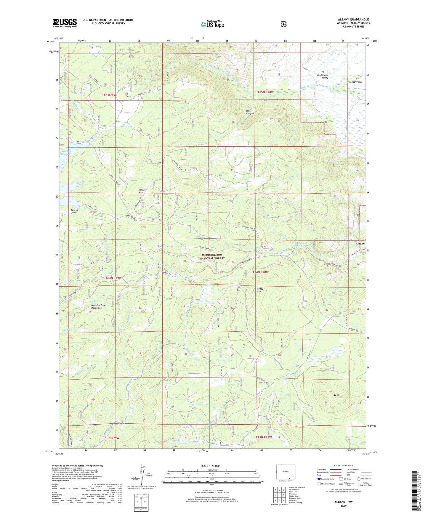
Albany Wyoming US Topo Map
Couldn't load pickup availability
Also explore the Albany Forest Service Topo of this same quad for updated USFS data
2021 topographic map quadrangle Albany in the state of Wyoming. Scale: 1:24000. Based on the newly updated USGS 7.5' US Topo map series, this map is in the following counties: Albany. The map contains contour data, water features, and other items you are used to seeing on USGS maps, but also has updated roads and other features. This is the next generation of topographic maps. Printed on high-quality waterproof paper with UV fade-resistant inks.
Quads adjacent to this one:
West: Keystone
Northwest: Medicine Bow Peak
North: Centennial
Northeast: Rex Lake
East: Lake Owen
Southeast: Woods Landing
South: Foxpark
Southwest: Horatio Rock
This map covers the same area as the classic USGS quad with code o41106b2.
Contains the following named places: Albany, Albany Census Designated Place, Albany Post Office, Bird Creek, Centennial Valley Volunteer Fire Department - Station 4, Cinnabar Park, Curitan Creek, Deerwood, Dry Park, Hay Creek, Hells Canyon, Hub Load Claim, Indian Creek, June Creek, Keystone Mine, Lake Creek Mine, Lake Mountain, Lake Resort Area Mine, Medicine Bow Mountains, Moores Gulch, Muddy Mountain, Muddy Park, Otto Lumber Camp, Spring Creek, Spruce Mountain