MyTopo
Rock Lake Peak Wyoming US Topo Map
Couldn't load pickup availability
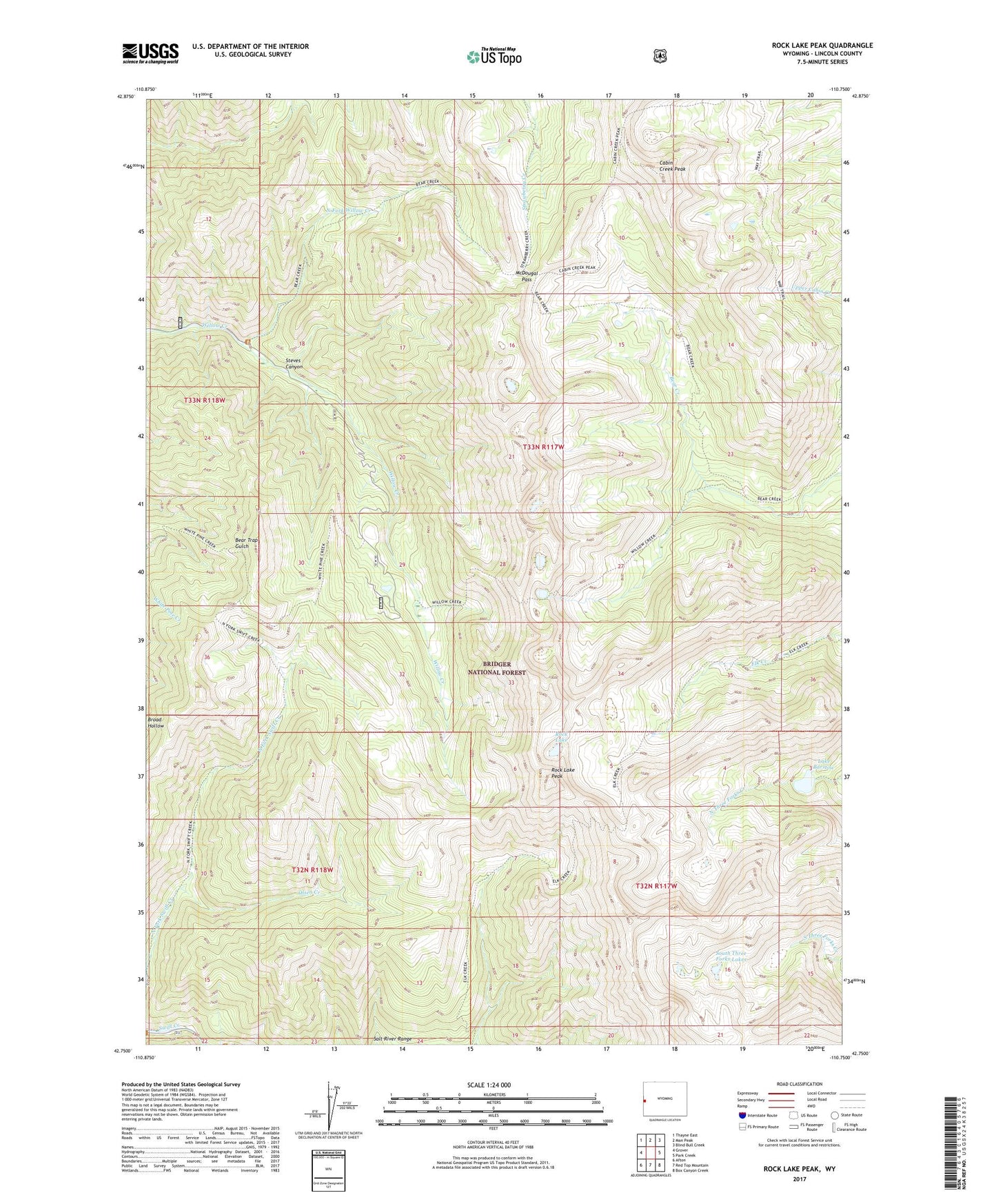
2021 topographic map quadrangle Rock Lake Peak in the state of Wyoming. Scale: 1:24000. Based on the newly updated USGS 7.5' US Topo map series, this map is in the following counties: Lincoln. The map contains contour data, water features, and other items you are used to seeing on USGS maps, but also has updated roads and other features. This is the next generation of topographic maps. Printed on high-quality waterproof paper with UV fade-resistant inks.
Quads adjacent to this one:
West: Grover
Northwest: Thayne East
North: Man Peak
Northeast: Blind Bull Creek
East: Park Creek
Southeast: Box Canyon Creek
South: Red Top Mountain
Southwest: Afton
Contains the following named places: Cabin Creek Peak, Cabin Creek Peak Lookout Tower, Dry Canyon Mine, Lake Barstow, McDougal Pass, McDouglas Pass Mine, North Fork Willow Creek, Olsen Creek, Rock Lake, Rock Lake Peak, Salt River Range, South Three Forks Lakes, Steves Canyon