
MyTopo
Saratoga Wyoming US Topo Map
Couldn't load pickup availability
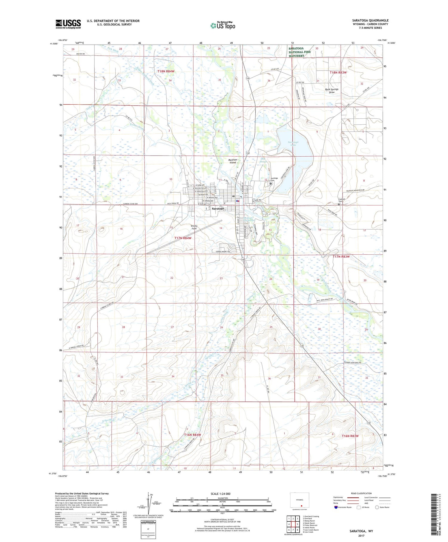
2021 topographic map quadrangle Saratoga in the state of Wyoming. Scale: 1:24000. Based on the newly updated USGS 7.5' US Topo map series, this map is in the following counties: Carbon. The map contains contour data, water features, and other items you are used to seeing on USGS maps, but also has updated roads and other features. This is the next generation of topographic maps. Printed on high-quality waterproof paper with UV fade-resistant inks.
Quads adjacent to this one:
West: Walck Ranch
Northwest: Overland Crossing
North: Overland
Northeast: Oberg Ranch
East: Finley Reservoir
Southeast: Cow Creek
South: Cow Creek Ranch
Southwest: Indian Rocks
Contains the following named places: Brauer Ditch, Buck Springs Draw, Cadwell Cemetery, Cadwell Slough, Cedar Creek, Davis, Foote Ranch, Forney Ditch, Hot Slough, Hugus Mullison Ditch, Lake Creek, Lake George, Lake George Dam, Lower Ditch, Mullison Island, North Spring Creek, Saratoga, Saratoga Cemetery, Saratoga Dam, Saratoga High School, Saratoga Hot Springs, Saratoga Lake, Saratoga Middle School, Saratoga Police Department, Saratoga Post Office, Saratoga School, Saratoga Volunteer Fire Department, Seahorn Brothers Sand and Gravel Pit, Shively Field, South Central Wyoming Emergency Medical Services - Saratoga, South Spring Creek, Spring Creek, Town of Saratoga


