MyTopo
Beaver Creek Wyoming US Topo Map
Couldn't load pickup availability
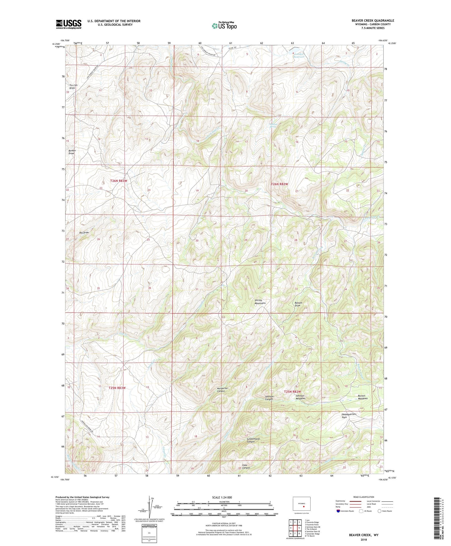
2021 topographic map quadrangle Beaver Creek in the state of Wyoming. Scale: 1:24000. Based on the newly updated USGS 7.5' US Topo map series, this map is in the following counties: Carbon. The map contains contour data, water features, and other items you are used to seeing on USGS maps, but also has updated roads and other features. This is the next generation of topographic maps. Printed on high-quality waterproof paper with UV fade-resistant inks.
Quads adjacent to this one:
West: Seminoe Dam NE
Northwest: Leo
North: Fourmile Ridge
Northeast: Fourmile Point
East: The Q Ranch
Southeast: T E Ranch
South: Schneider Ridge
Southwest: Seminoe Dam SE
This map covers the same area as the classic USGS quad with code o42106b6.
Contains the following named places: A Number One Claim, Balsam Draw, Beaver Creek, Beaver Number One Claim, Button Meadows, Campbell Headquarters Camp, Cowden Reservoir, Dee Number One Claim, Headquarters Park, Johnson Canyon, Johnson Meadows, Norbacher Canyon, Salmi Ranch, Schoolhouse Canyon, Sullivan Spring, Tikkinen Ranch, ZIP Code: 82327