MyTopo
Sherman Mountains West Wyoming US Topo Map
Couldn't load pickup availability
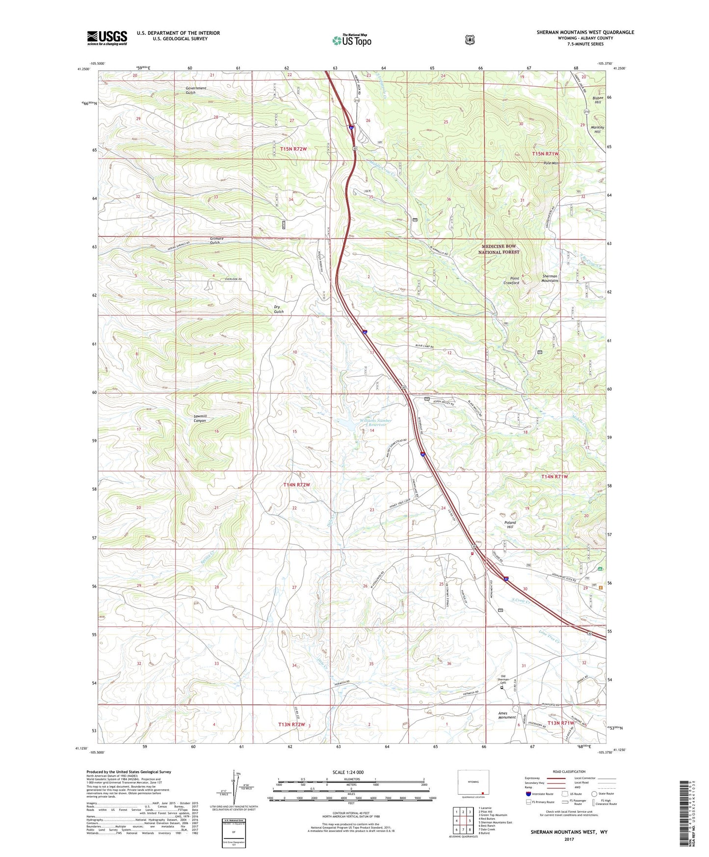
2021 topographic map quadrangle Sherman Mountains West in the state of Wyoming. Scale: 1:24000. Based on the newly updated USGS 7.5' US Topo map series, this map is in the following counties: Albany. The map contains contour data, water features, and other items you are used to seeing on USGS maps, but also has updated roads and other features. This is the next generation of topographic maps. Printed on high-quality waterproof paper with UV fade-resistant inks.
Quads adjacent to this one:
West: Red Buttes
Northwest: Laramie
North: Pilot Hill
Northeast: Green Top Mountain
East: Sherman Mountains East
Southeast: Buford
South: Dale Creek
Southwest: Best Ranch
Contains the following named places: Ames Monument, Bennet Hill, Bisbee Hill, Browns Landing, Hidden Valley Picnic Area, Lincoln Trail, Lower Blair Picnic Area, Markley Hill, Mellody Ranch, Old Sherman Cemetery, Perue Ranch, Point Crawford, Poland Hill, Pole Mountain, Pole Mountain Ranger Station, Pole Mountain Trail, Pole Mountain Work Center, Sawmill Gulch, Sherman Mountains, The Summit, Upper Blair Picnic Area, Vedauwoo Volunteer Fire Department, Wallis Recreation Area, Warren Sheep Camp, Williams Number 3 Dam, Williams Number 3 Reservoir