MyTopo
Skull Creek Wyoming US Topo Map
Couldn't load pickup availability
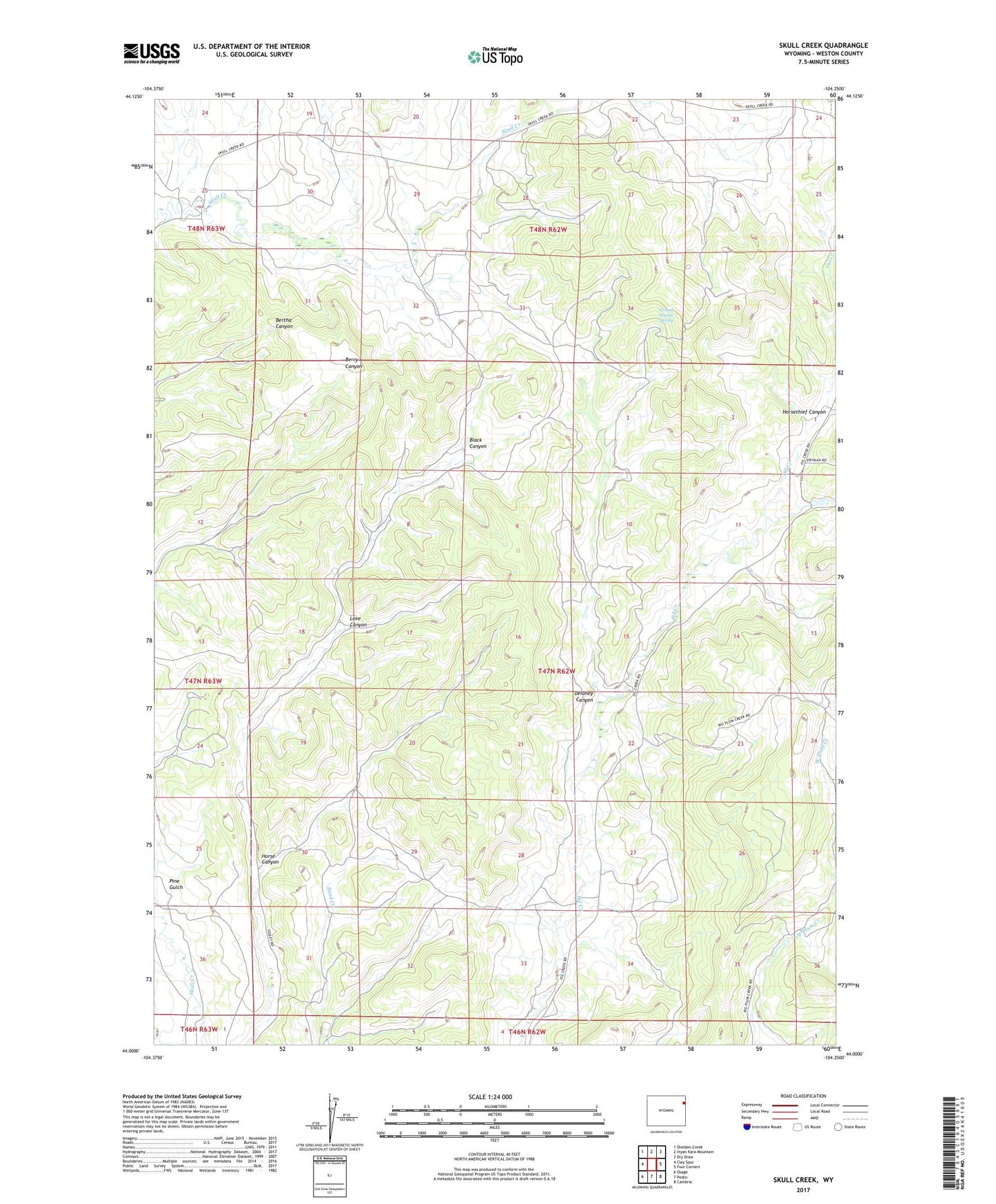
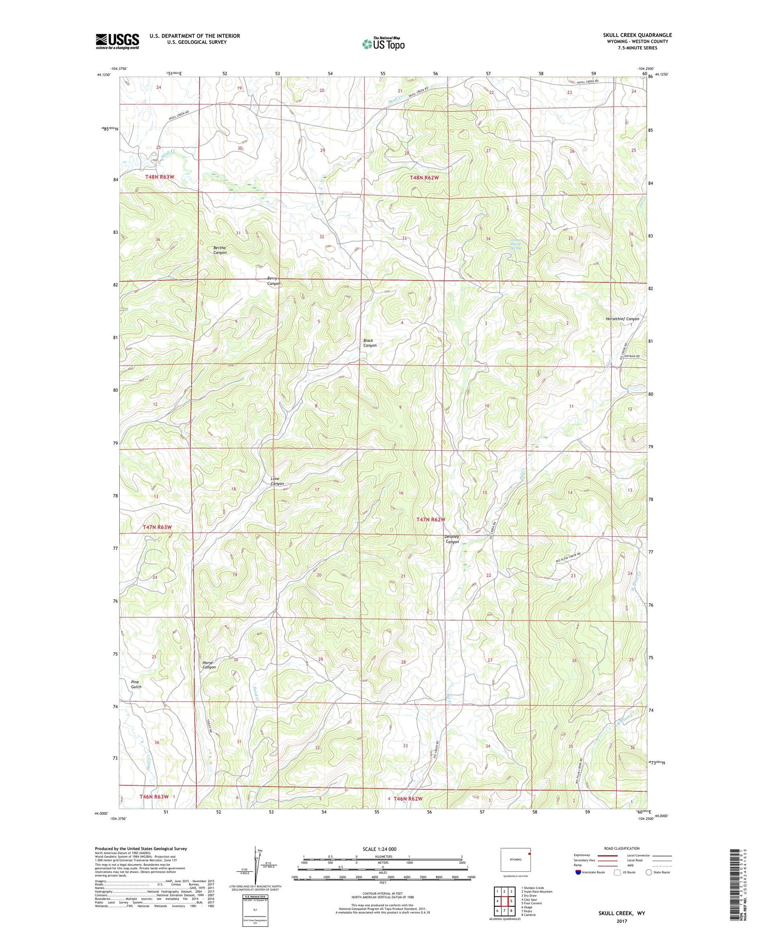
2021 topographic map quadrangle Skull Creek in the state of Wyoming. Scale: 1:24000. Based on the newly updated USGS 7.5' US Topo map series, this map is in the following counties: Weston. The map contains contour data, water features, and other items you are used to seeing on USGS maps, but also has updated roads and other features. This is the next generation of topographic maps. Printed on high-quality waterproof paper with UV fade-resistant inks.
Quads adjacent to this one:
West: Clay Spur
Northwest: Sheldon Creek
North: Inyan Kara Mountain
Northeast: Dry Draw
East: Four Corners
Southeast: Cambria
South: Pedro
Southwest: Osage
Contains the following named places: Big Delaney Dam, Big Delaney Reservoir, Delaney Canyon, Grand Stump Spring, Holwell Prospects One and Two Mine, Horse Canyon, Love Canyon, Oil Creek Mine, Perino Dam, Perino Reservoir, Pine Gulch, Red Creek, Red Creek Area Mine, Skull Creek, Tavegia School, V E Lissolo Dam, V E Lissolo Reservoir