MyTopo
Spanish Point Wyoming US Topo Map
Couldn't load pickup availability
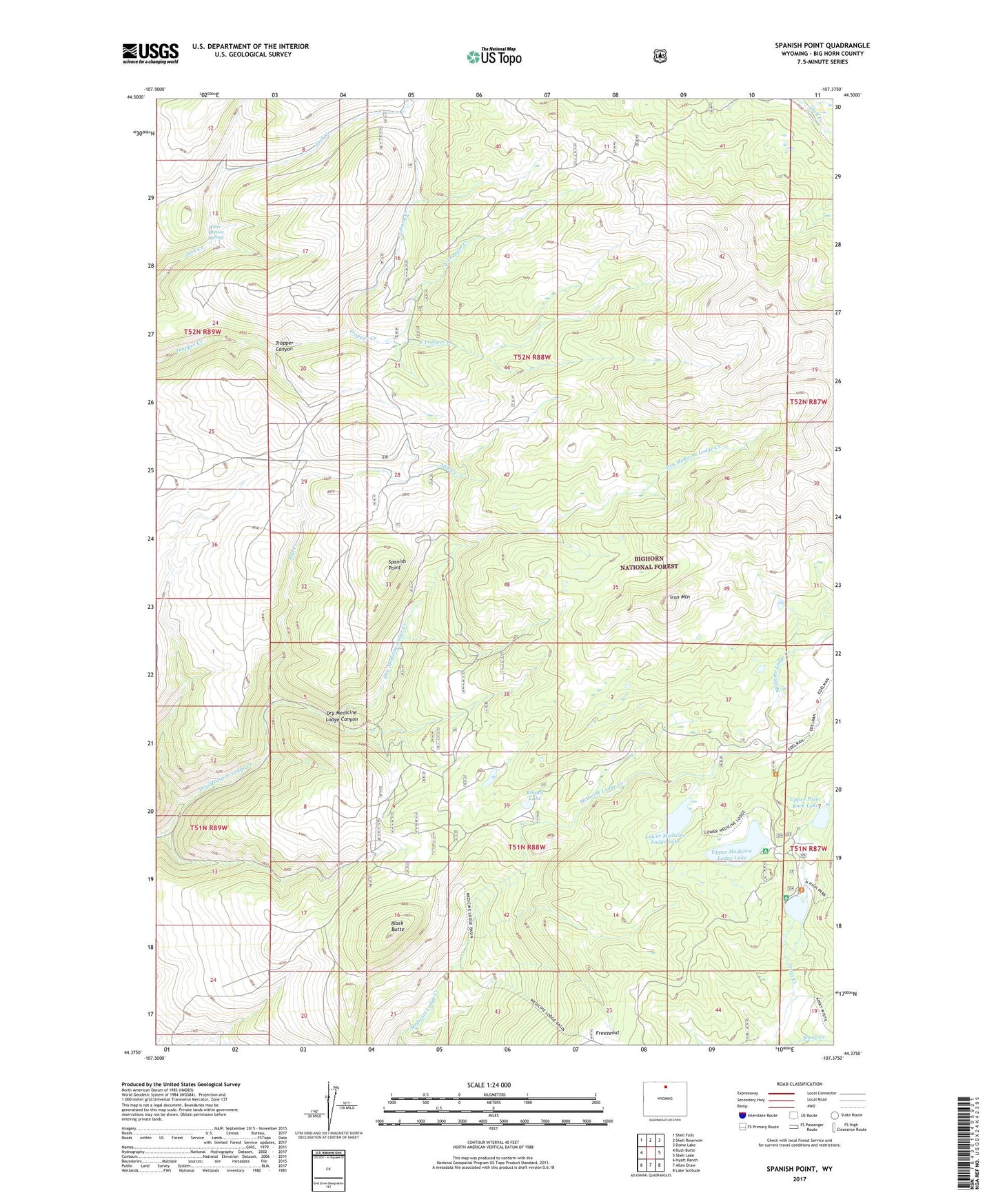
2021 topographic map quadrangle Spanish Point in the state of Wyoming. Scale: 1:24000. Based on the newly updated USGS 7.5' US Topo map series, this map is in the following counties: Big Horn. The map contains contour data, water features, and other items you are used to seeing on USGS maps, but also has updated roads and other features. This is the next generation of topographic maps. Printed on high-quality waterproof paper with UV fade-resistant inks.
Quads adjacent to this one:
West: Bush Butte
Northwest: Shell Falls
North: Shell Reservoir
Northeast: Dome Lake
East: Shell Lake
Southeast: Lake Solitude
South: Allen Draw
Southwest: Hyatt Ranch
Contains the following named places: Black Butte, Freezeout, Iron Mountain, Johnny Creek, Lower Medicine Lodge Lake, Lower Paint Rock Lake, Lower Paint Rock Lake Campground, Medicine Lodge Big Game Winter Range, Medicine Lodge Lake Campground, Mill Creek, North Trapper Creek, Paint Rock Lakes Guard Station, Paint Rock Lodge, Round Lake, South Trapper Creek, Spanish Point, Spanish Point Agate Mine, Taylor Cow Camp, Upper Medicine Lodge Lake, Upper Paint Rock Lake, Upper Paint Rock Lake Campground, White Bottom Spring