MyTopo
Sweetwater Gap Wyoming US Topo Map
Couldn't load pickup availability
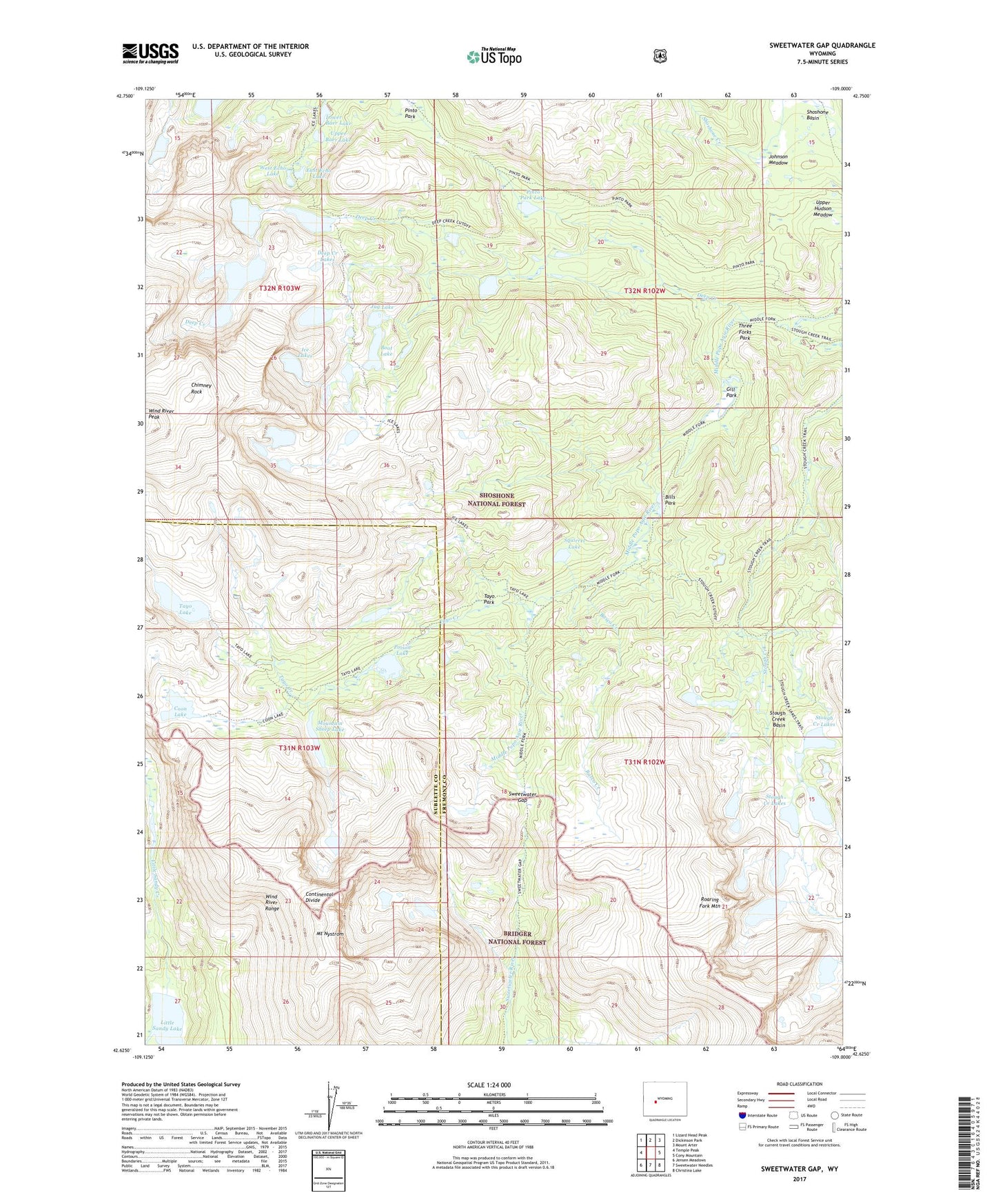
2021 topographic map quadrangle Sweetwater Gap in the state of Wyoming. Scale: 1:24000. Based on the newly updated USGS 7.5' US Topo map series, this map is in the following counties: Fremont, Sublette. The map contains contour data, water features, and other items you are used to seeing on USGS maps, but also has updated roads and other features. This is the next generation of topographic maps. Printed on high-quality waterproof paper with UV fade-resistant inks.
Quads adjacent to this one:
West: Temple Peak
Northwest: Lizard Head Peak
North: Dickinson Park
Northeast: Mount Arter
East: Cony Mountain
Southeast: Christina Lake
South: Sweetwater Needles
Southwest: Jensen Meadows
Contains the following named places: Baer Lakes, Basco Creek, Bills Park, Boot Lake, Chimney Rock, Coon Lake, Deep Creek, Deep Creek Lakes, East Echo Lake, Echo Lakes, Gill Park, Ice Lakes, Johnson Meadow, Jug Lake, Little Sandy Lake, Lower Baer Lake, Mount Nystrom, Mountain Sheep Lake, Pinto Park, Pinto Park Lake, Pinto Park Trail, Poison Lake, Popo Agie Wilderness, Shoshone Basin, Squirrel Lake, Stough Creek Basin, Stough Creek Basin Trail, Stough Creek Lakes, Sweetwater Gap, Tayo Creek, Tayo Lake, Tayo Park, Three Forks Park, Upper Baer Lake, Upper Hudson Meadow, West Echo Lake