
MyTopo
Sweetwater Needles Wyoming US Topo Map
Couldn't load pickup availability
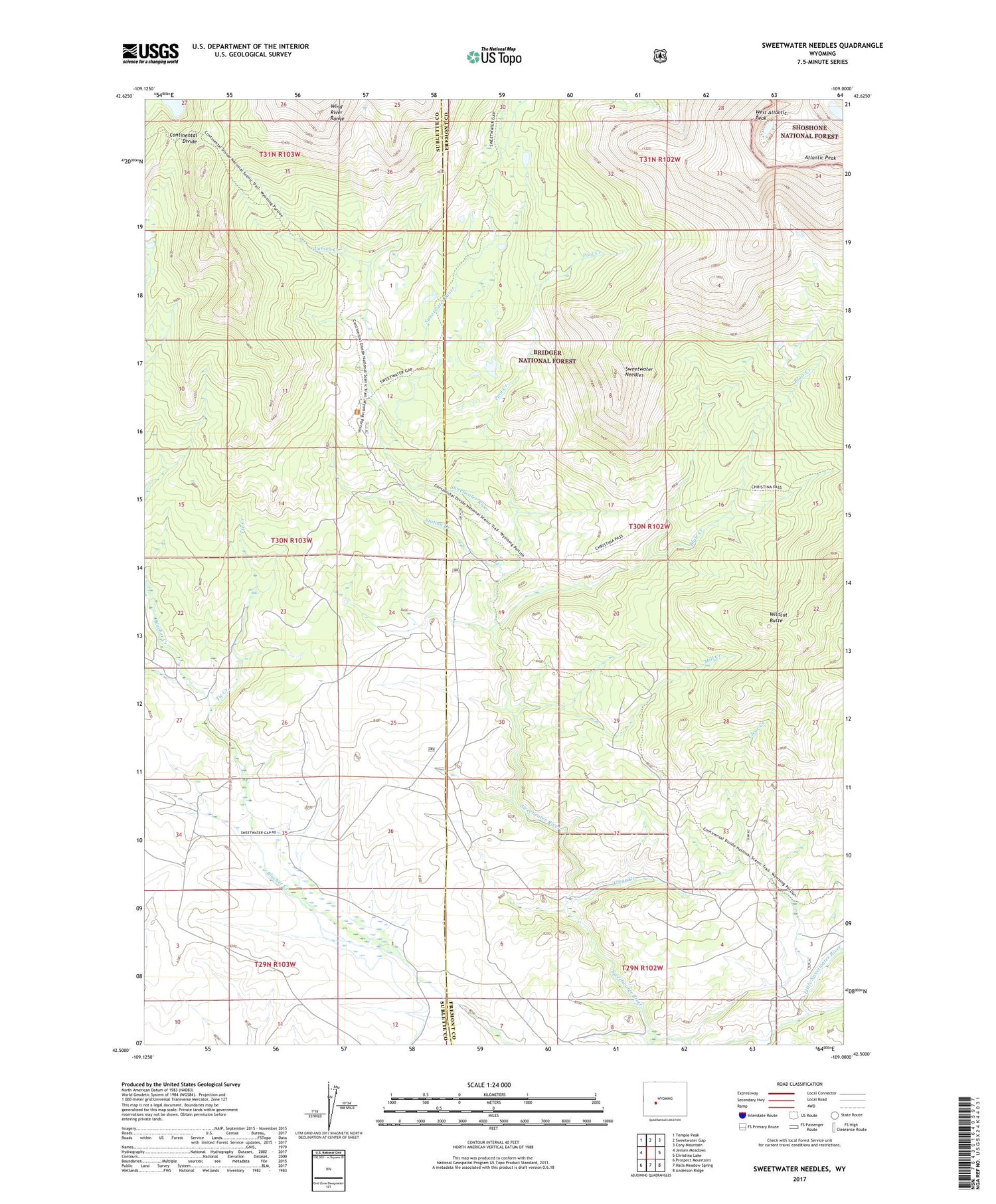
2021 topographic map quadrangle Sweetwater Needles in the state of Wyoming. Scale: 1:24000. Based on the newly updated USGS 7.5' US Topo map series, this map is in the following counties: Fremont, Sublette. The map contains contour data, water features, and other items you are used to seeing on USGS maps, but also has updated roads and other features. This is the next generation of topographic maps. Printed on high-quality waterproof paper with UV fade-resistant inks.
Quads adjacent to this one:
West: Jensen Meadows
Northwest: Temple Peak
North: Sweetwater Gap
Northeast: Cony Mountain
East: Christina Lake
Southeast: Anderson Ridge
South: Halls Meadow Spring
Southwest: Prospect Mountains
Contains the following named places: Atlantic Peak, Blair Creek, Christina Lake Trail, Clear Creek, Larsen Creek, Little Sweetwater River, Mill Creek, Pool Creek, Roaring Fork Mountain, Station Creek, Sweetwater Gap Ranch, Sweetwater Guard Station, Sweetwater Needles, Sweetwater Trail, Tie Creek, West Atlantic Peak, White Acorn Ranch, Wildcat Butte


