MyTopo
Turpin Reservoir Wyoming US Topo Map
Couldn't load pickup availability
Also explore the Turpin Reservoir Forest Service Topo of this same quad for updated USFS data
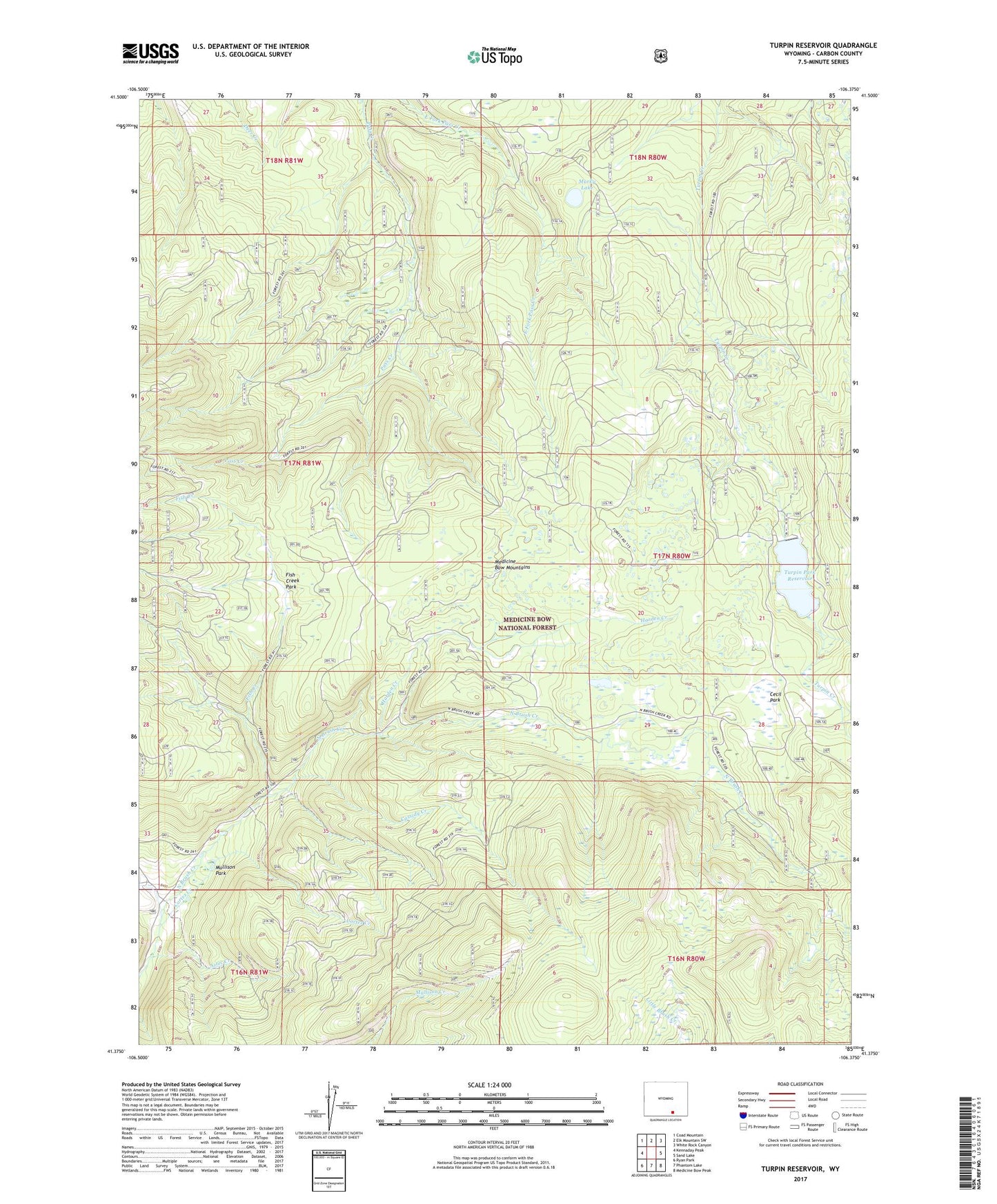
2021 topographic map quadrangle Turpin Reservoir in the state of Wyoming. Scale: 1:24000. Based on the newly updated USGS 7.5' US Topo map series, this map is in the following counties: Carbon. The map contains contour data, water features, and other items you are used to seeing on USGS maps, but also has updated roads and other features. This is the next generation of topographic maps. Printed on high-quality waterproof paper with UV fade-resistant inks.
Quads adjacent to this one:
West: Kennaday Peak
Northwest: Coad Mountain
North: Elk Mountain SW
Northeast: White Rock Canyon
East: Sand Lake
Southeast: Medicine Bow Peak
South: Phantom Lake
Southwest: Ryan Park
This map covers the same area as the classic USGS quad with code o41106d4.
Contains the following named places: Aztec Creek, Brown Number 1 Dam, Brown Number 1 Reservoir, Cassidy Creek, Cecil Park, Cortez Creek, Fish Creek, Fish Creek Park, Golden Gate Prospect, Harden Creek, Mullison Park, Murky Lake, Turpin Park Dam, Turpin Park Reservoir, Turpin Reservoir