MyTopo
Medicine Bow Peak Wyoming US Topo Map
Couldn't load pickup availability
Also explore the Medicine Bow Peak Forest Service Topo of this same quad for updated USFS data
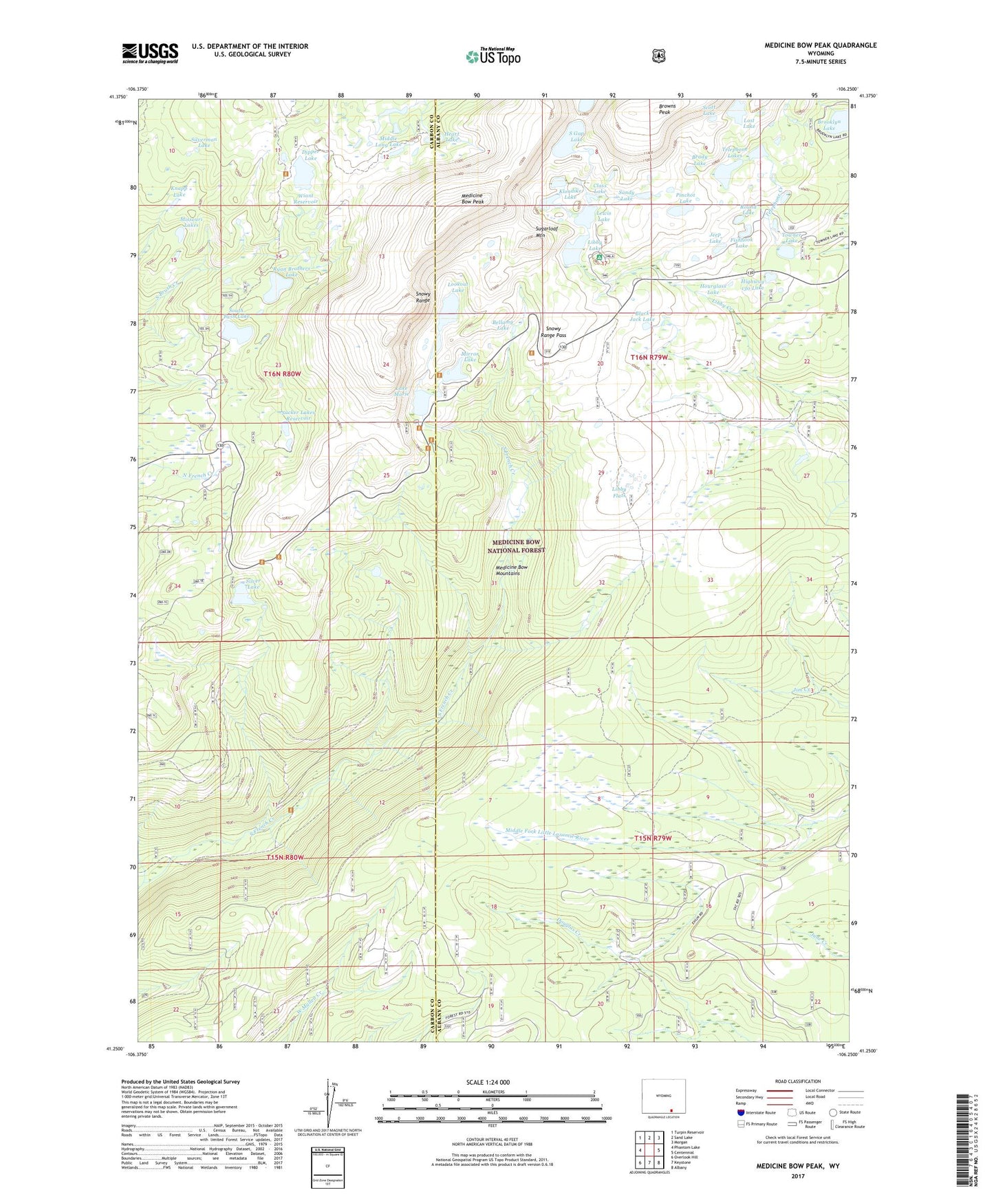
2021 topographic map quadrangle Medicine Bow Peak in the state of Wyoming. Scale: 1:24000. Based on the newly updated USGS 7.5' US Topo map series, this map is in the following counties: Albany, Carbon. The map contains contour data, water features, and other items you are used to seeing on USGS maps, but also has updated roads and other features. This is the next generation of topographic maps. Printed on high-quality waterproof paper with UV fade-resistant inks.
Quads adjacent to this one:
West: Phantom Lake
Northwest: Turpin Reservoir
North: Sand Lake
Northeast: Morgan
East: Centennial
Southeast: Albany
South: Keystone
Southwest: Overlook Hill
This map covers the same area as the classic USGS quad with code o41106c3.
Contains the following named places: Bellamy Lake, Black Jack Lake, Brady Lake, Brooklyn Lake, Browns Peak, Circle Trail, Class Lake, Dipper Lake, First Enlargement of Wiant Dam, Fishhook Lake, Fourlog Park, Hat Park, Hatchet Lake, Headquarters Park, Heart Lake, Highway 130 Lake, Hourglass Lake, Jeep Lake, Keystone Dam, Keystone Reservoir, Klondike Lake, Knapp Lake, Lake Marie, Lake Marie Picnic Ground, Lakes Trail, Lewis Lake, Lewis Lake Campground, Libby Flats, Libby Flats Observation Shed, Libby Lake, Little Brooklyn Lake Dam, Lookout Lake, Lorain Group Mine, Lost Lake, Lower Missouri Lake, Medicine Bow National Forest, Medicine Bow Peak, Medicine Bow Trail, Middle Long Lake, Mirror Lake, Mirror Lake Campground, Missouri Lakes, Nelson Park, North Twin Lake, Pinchot Lake, Round Lake, Ryan Brothers Lake, Ryan Brothers Lake Dam, Sandy Lake, Scott Lake, Silver Lake, Silver Lake Campground, Silverman Lake, Snowy Range Pass, South Gap Lake, South Twin Lake, Sucker Dam, Sucker Lake, Sugarloaf Mountain, Sugarloaf Recreation Area, Telephone Lakes, Towner Lake, Upper Missouri Lake, Wiant Number 2 Dam, Wiant Reservoir, Willow Park