MyTopo
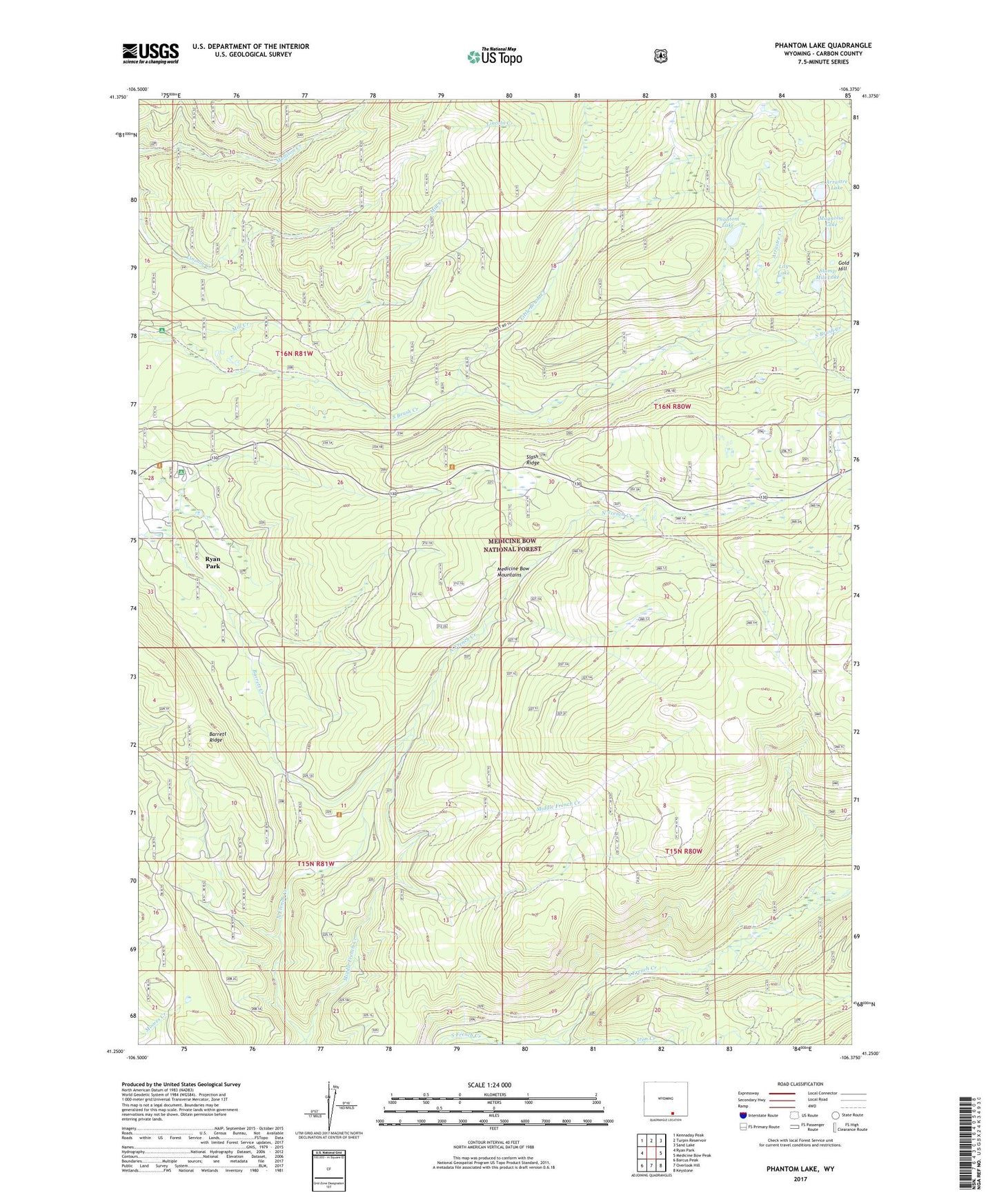
Phantom Lake Wyoming US Topo Map
Couldn't load pickup availability
Also explore the Phantom Lake Forest Service Topo of this same quad for updated USFS data
2021 topographic map quadrangle Phantom Lake in the state of Wyoming. Scale: 1:24000. Based on the newly updated USGS 7.5' US Topo map series, this map is in the following counties: Carbon. The map contains contour data, water features, and other items you are used to seeing on USGS maps, but also has updated roads and other features. This is the next generation of topographic maps. Printed on high-quality waterproof paper with UV fade-resistant inks.
Quads adjacent to this one:
West: Ryan Park
Northwest: Kennaday Peak
North: Turpin Reservoir
Northeast: Sand Lake
East: Medicine Bow Peak
Southeast: Keystone
South: Overlook Hill
Southwest: Barcus Peak
This map covers the same area as the classic USGS quad with code o41106c4.
Contains the following named places: Araster Dam, Araster Reservoir, Arrastre Creek, Arrastre Lake, Barrett Ridge, Gold Hill, Headquarters Creek, Iron Creek, Lily Lake, Little Brush Creek, Magnolia Lake, Middle French Creek, Mill Creek, Phantom Lake, Raven Group Mine, Ryan Park Census Designated Place, Slash Ridge, Slash Ridge Lookout, Stamp Mill Lake