MyTopo
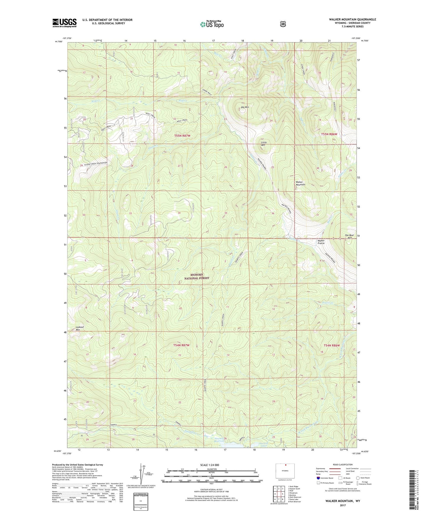
Walker Mountain Wyoming US Topo Map
Couldn't load pickup availability
2021 topographic map quadrangle Walker Mountain in the state of Wyoming. Scale: 1:24000. Based on the newly updated USGS 7.5' US Topo map series, this map is in the following counties: Sheridan. The map contains contour data, water features, and other items you are used to seeing on USGS maps, but also has updated roads and other features. This is the next generation of topographic maps. Printed on high-quality waterproof paper with UV fade-resistant inks.
Quads adjacent to this one:
West: Woodrock
Northwest: Skull Ridge
North: Dayton South
Northeast: Wolf
East: Beckton
Southeast: Park Reservoir
South: Dome Lake
Southwest: Shell Reservoir
Contains the following named places: Alden Creek, Bear Creek, Big Mountain, Buck Creek, Game Creek Trail, Gloom Creek, Little Mountain, Mosaic Claim Mine, Quartz Creek, Quartz Creek Cow Camp, Roosevelt Trail, Sawmill Creek, Sawmill Reservoir, She-Bear Mountain, Sibley Creek, Taylor Mine, Walker Mountain, Walker Prairie, Walkers Mine, Wolf Creek Trail