MyTopo
Arkadelphia Alabama US Topo Map
Couldn't load pickup availability
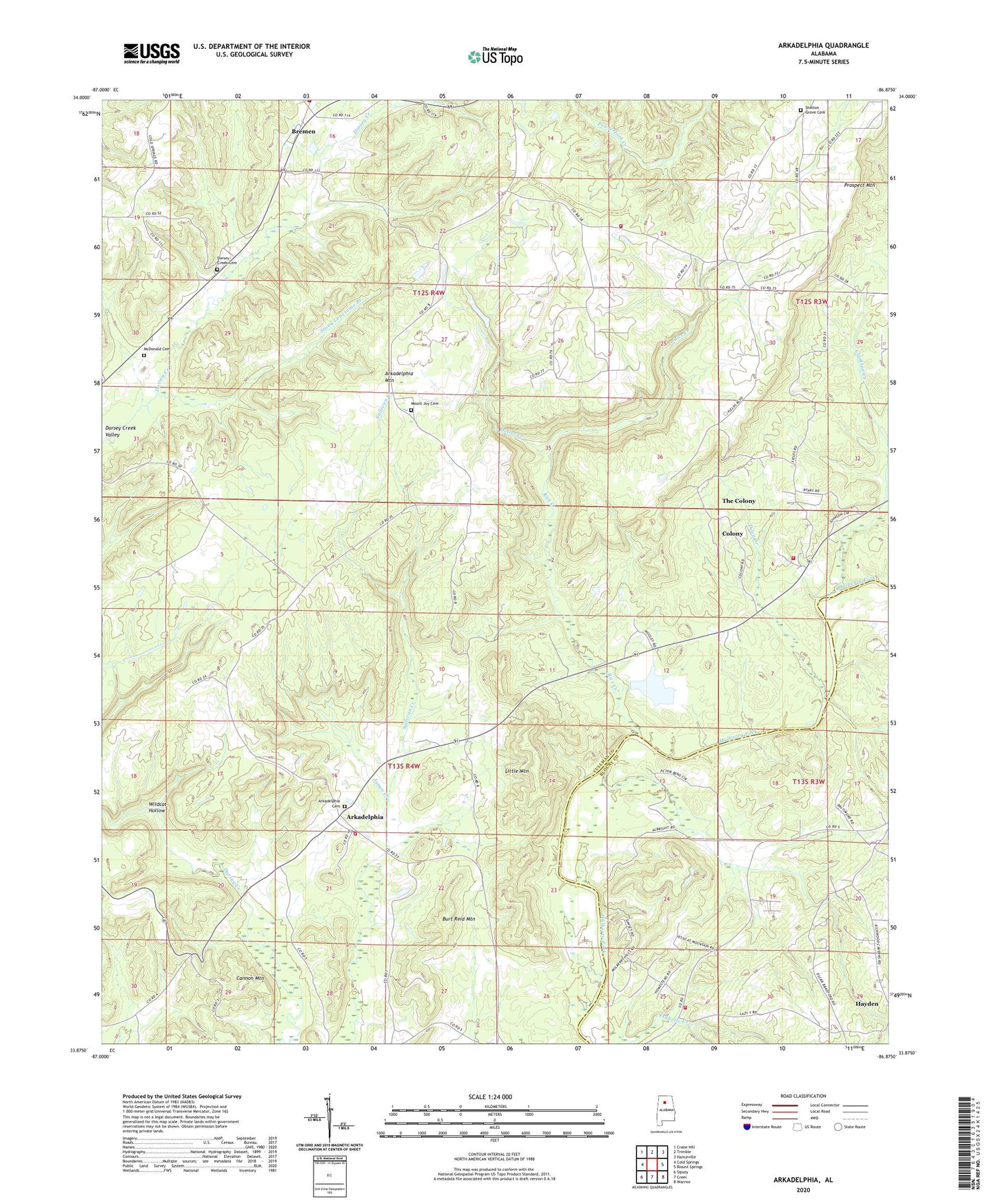
2024 topographic map quadrangle Arkadelphia in the state of Alabama. Scale: 1:24000. Based on the newly updated USGS 7.5' US Topo map series, this map is in the following counties: Cullman, Blount. The map contains contour data, water features, and other items you are used to seeing on USGS maps, but also has updated roads and other features. This is the next generation of topographic maps. Printed on high-quality waterproof paper with UV fade-resistant inks.
Quads adjacent to this one:
West: Cold Springs
Northwest: Crane Hill
North: Trimble
Northeast: Hanceville
East: Blount Springs
Southeast: Warrior
South: Creel
Southwest: Sipsey
This map covers the same area as the classic USGS quad with code o33086h8.
Contains the following named places: Arkadelphia, Arkadelphia Cemetery, Arkadelphia Community Center, Arkadelphia Elementary School, Arkadelphia First Baptist Church, Arkadelphia First United Methodist Church, Arkadelphia Mine, Arkadelphia Mountain, Arkadelphia Post Office, Arkadelphia Volunteer Fire Department Station 1, Baltimore, Baltimore Ford, Bethel Church of God, Bethesda Church of Christ, Bremen, Bremen Community Center, Bremen Division, Bremen Missionary Baptist Church, Bremen School, Bremen Volunteer Fire Department Station 1, Bremen Volunteer Fire Department Station 3, Burt Reid Mountain, Cannon Mountain, Clarkton Creek, Clefty Mine, Collins Chapel Church of God, Colony High School, Colony Volunteer Fire Department, Danzler, Dean Creek, Dollar Creek, Dorsey Creek Cemetery, Dorsey Creek Valley, Dorseys Creek Primitive Baptist Church, Enterprise Church, Fairview Baptist Church, First Pentecostal Church, Forrest Ingram Dam, Friendship Church, Ingram Arkadelphia Lake, James Creek, Jesus Only Holiness Church, Juliana Drift Mine, Liberty Church, Little Mountain, McDonald Cemetery, Mount High Fire and Rescue Station 2, Mount Joy Cemetery, Mount Joy Missionary Baptist Church, New Hope Church, New Prospect Baptist Church, New Prospect School, Pleasant Hill Church, Prospect Mountain, Rice Creek, Shelton Grove Cemetery, Shelton Grove Missionary Baptist Church, Stony Lonesome Branch, Sulpher Springs School, Sulphur Springs Church, The Colony, Town of Colony, Tremble Mine, Valley View Missionary Baptist Church, Wildcat Hollow