MyTopo
Creel Alabama US Topo Map
Couldn't load pickup availability
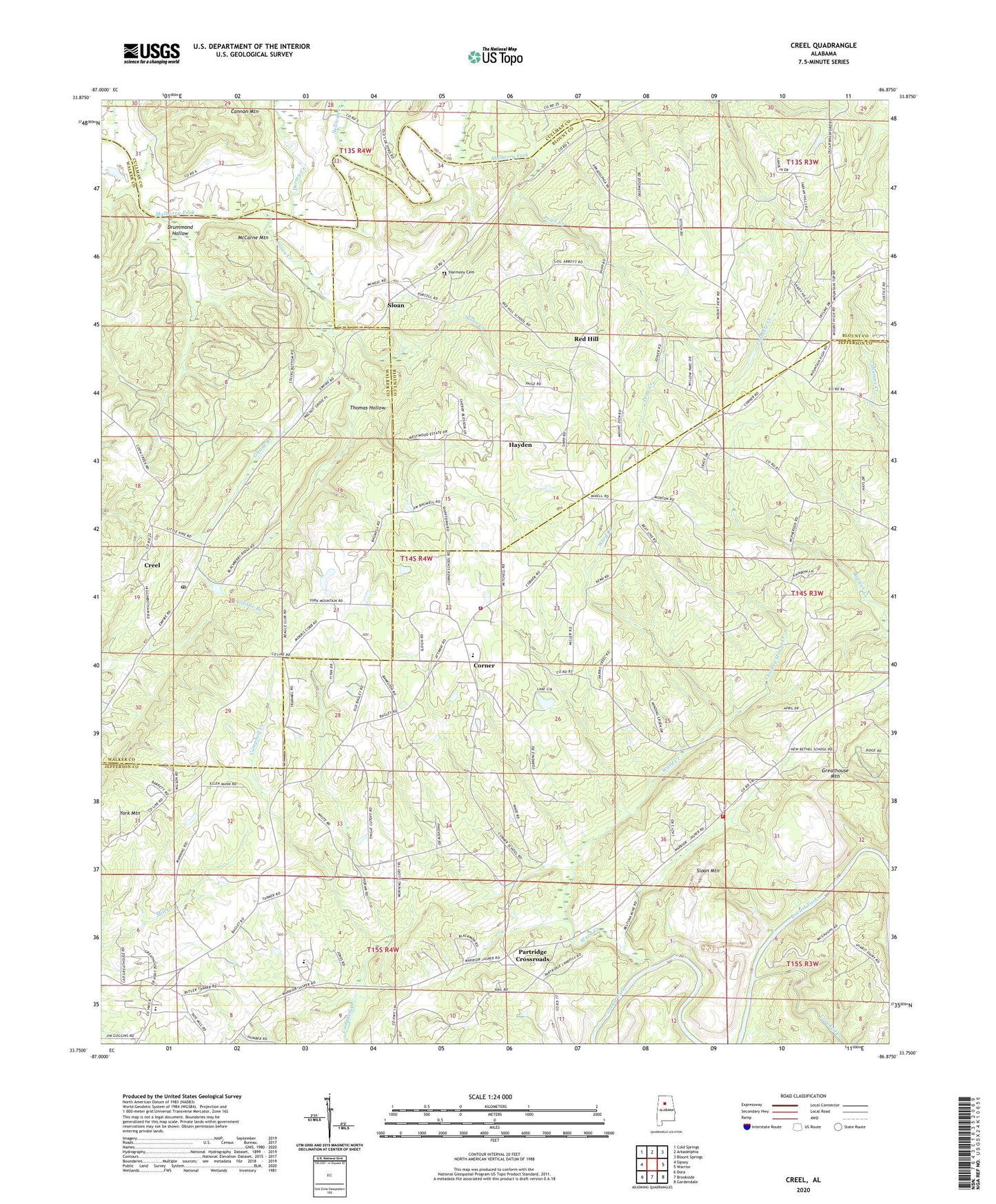
2024 topographic map quadrangle Creel in the state of Alabama. Scale: 1:24000. Based on the newly updated USGS 7.5' US Topo map series, this map is in the following counties: Jefferson, Blount, Walker, Cullman. The map contains contour data, water features, and other items you are used to seeing on USGS maps, but also has updated roads and other features. This is the next generation of topographic maps. Printed on high-quality waterproof paper with UV fade-resistant inks.
Quads adjacent to this one:
West: Sipsey
Northwest: Cold Springs
North: Arkadelphia
Northeast: Blount Springs
East: Warrior
Southeast: Gardendale
South: Brookside
Southwest: Dora
This map covers the same area as the classic USGS quad with code o33086g8.
Contains the following named places: Antioch Church, Bagley Junior High School, Bagley Meadows, Beltona Mine, Bohannon Mine, Carpet Rock Mine, Chicken House Creek, Corner, Corner Elementary School, Corner High School, Corner Volunteer Fire and Rescue Service Station 1, Corner Volunteer Fire and Rescue Service Station 2, Creel, Crooked Creek, Dorsey Creek, Drummond Hollow, Empire Church, Empire Number 2 Mine, Empire Post Office, Frog Ridge Church, Gleade Branch, Greathouse Mountain, Hanby Mill, Harmony Baptist Church, Harmony Baptist Church Cemetery, Hollow Hills Park, Isabelle Creek, Knob Mine, Knob Mine Number 2, Little Vine Church, McCarne Mountain, Mount Zion Church, Mountain View Church, New Bethel Church, New Temple Church, New Zion Hill Church, Partridge Crossroads, Partridge Sanitary Landfill, Pleasant Hill Church, Price Creek, Red Hill, Red Hill Church, Red Hill School, Skyline Drive Church, Sloan, Sloan Creek, Sloan Mountain, Sullivan Creek, Sullivan Ford, Temple Hill Church, Thomas Hollow, Union Church, Union Grove School, Valley Grove Church, Ward Creek, Willow Grove Estates, Wylam Number 4 Mine, York Mountain