MyTopo
Gaston Alabama US Topo Map
Couldn't load pickup availability
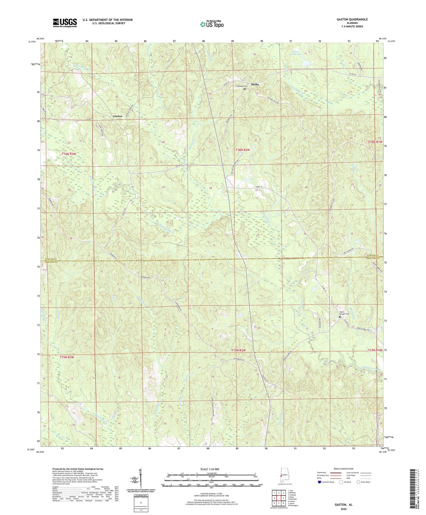
2024 topographic map quadrangle Gaston in the state of Alabama. Scale: 1:24000. Based on the newly updated USGS 7.5' US Topo map series, this map is in the following counties: Choctaw, Sumter. The map contains contour data, water features, and other items you are used to seeing on USGS maps, but also has updated roads and other features. This is the next generation of topographic maps. Printed on high-quality waterproof paper with UV fade-resistant inks.
Quads adjacent to this one:
West: Ward
Northwest: York
North: Bellamy
Northeast: Coatopa
East: Whitfield
Southeast: Pennington
South: Jachin
Southwest: Lisman
This map covers the same area as the classic USGS quad with code o32088c2.
Contains the following named places: Allison Derby Dam, Allison Derby Lake, Brockway Creek, Bryan Store, Burnam Branch, Campbell Cemetery, Cane Creek, Cedar Grove Baptist Church, Cooper Mission Christian Methodist Episcopal Church, Cotohaga Beat, Derby, Gaston, Gaston Valley, Gaston Valley Church, Hickory Hill, Hickory Hill Fire Tower, Hickory Hunting Club, Jack Branch, Mobile Branch, Mount Moriah Missionary Baptist Church, Mount Pisgah Baptist Church, Pine Grove African Methodist Episcopal Zion Church, Polecat Creek, Pritchetts Store, Saint Johns Church, Saint Thomas African Methodist Episcopal Zion Church, Sand Branch, Shorts, Shorts Church, Slay Branch, Ward Chapel African Methodist Episcopal Zion Church, Ward Chapel Cemetery, Watkins Store, ZIP Code: 36922