MyTopo
Ward Alabama US Topo Map
Couldn't load pickup availability
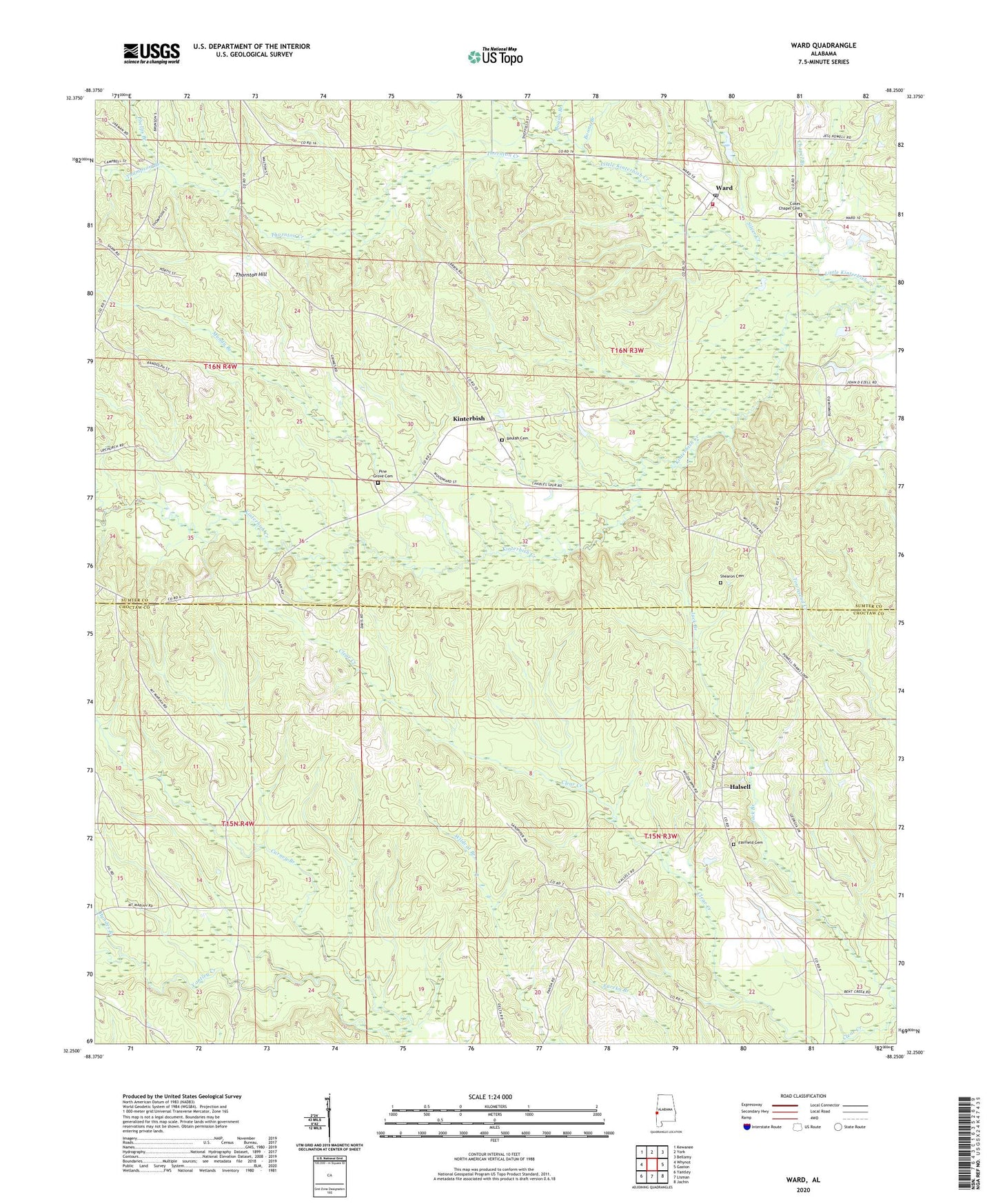
2024 topographic map quadrangle Ward in the state of Alabama. Scale: 1:24000. Based on the newly updated USGS 7.5' US Topo map series, this map is in the following counties: Sumter, Choctaw. The map contains contour data, water features, and other items you are used to seeing on USGS maps, but also has updated roads and other features. This is the next generation of topographic maps. Printed on high-quality waterproof paper with UV fade-resistant inks.
Quads adjacent to this one:
West: Whynot
Northwest: Kewanee
North: York
Northeast: Bellamy
East: Gaston
Southeast: Jachin
South: Lisman
Southwest: Yantley
This map covers the same area as the classic USGS quad with code o32088c3.
Contains the following named places: Beulah Baptist Church, Beulah Cemetery, Big Rack Club, Bogan Branch, Boone Branch, Chapel Branch, Charles, Cokes Chapel, Cokes Chapel Cemetery, Cokes Chapel Methodist Church, Cuba Head Start School, Fairfield Cemetery, Fairfield Christian Methodist Episcopal Church, Halsell, Halsell Church, Halsell United Methodist Church, Holiness Church, Hyndes Branch, John the Baptist Church, Johnson Creek, Kinterbish, Kinterbish State Wildlife Management Area, Little Kinterbish Creek, Means, Mount Moriah Baptist Church, Mundy Branch, Phelps Branch, Pine Grove Baptist Church, Pine Grove Cemetery, Shearon Cemetery, Silver Creek, Thomas E Huckabee Lake, Thomas E Huckabee Lake Dam, Thompson Branch, Thornton Creek, Thornton Hill, Ward, Ward Church, Ward Post Office, Ward Volunteer Fire Department