MyTopo
Collirene Alabama US Topo Map
Couldn't load pickup availability
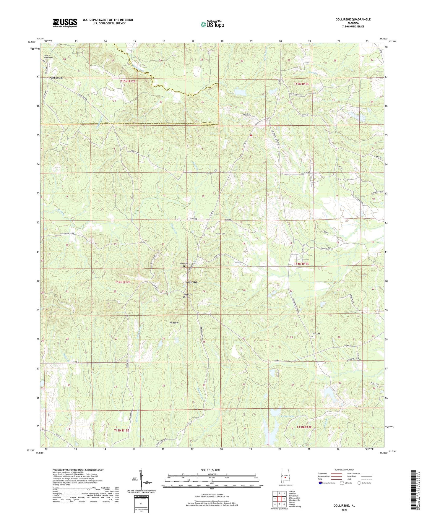
2024 topographic map quadrangle Collirene in the state of Alabama. Scale: 1:24000. Based on the newly updated USGS 7.5' US Topo map series, this map is in the following counties: Lowndes, Dallas. The map contains contour data, water features, and other items you are used to seeing on USGS maps, but also has updated roads and other features. This is the next generation of topographic maps. Printed on high-quality waterproof paper with UV fade-resistant inks.
Quads adjacent to this one:
West: Pleasant Hill
Northwest: Sardis
North: Benton
Northeast: White Hall
East: Gordonsville
Southeast: Mount Willing
South: Braggs
Southwest: Minter
This map covers the same area as the classic USGS quad with code o32086b7.
Contains the following named places: Benton-Collirene Division, Bethany Baptist Church, Bethel Church, Church Branch, Collirene, Collirene Volunteer Fire Department, Dunklin Cemetery, J R Paul Lake, J R Paul Lake Dam, Macedonia Church, Macedonia School, Mount Baber, Mount Cemetery, Mount Lily Church, Mount Lily School, Mount Teman Church, New Bethel Church, Old Bethel Church, Old Town, Petronia School, Ramer Church, Rives Cemetery, Shiloh Baptist Church, Shiloh Cemetery, Shiloh School, Town Creek Cemetery, Union Springs Church, WSLA-TV (Selma)