MyTopo
Sardis Alabama US Topo Map
Couldn't load pickup availability
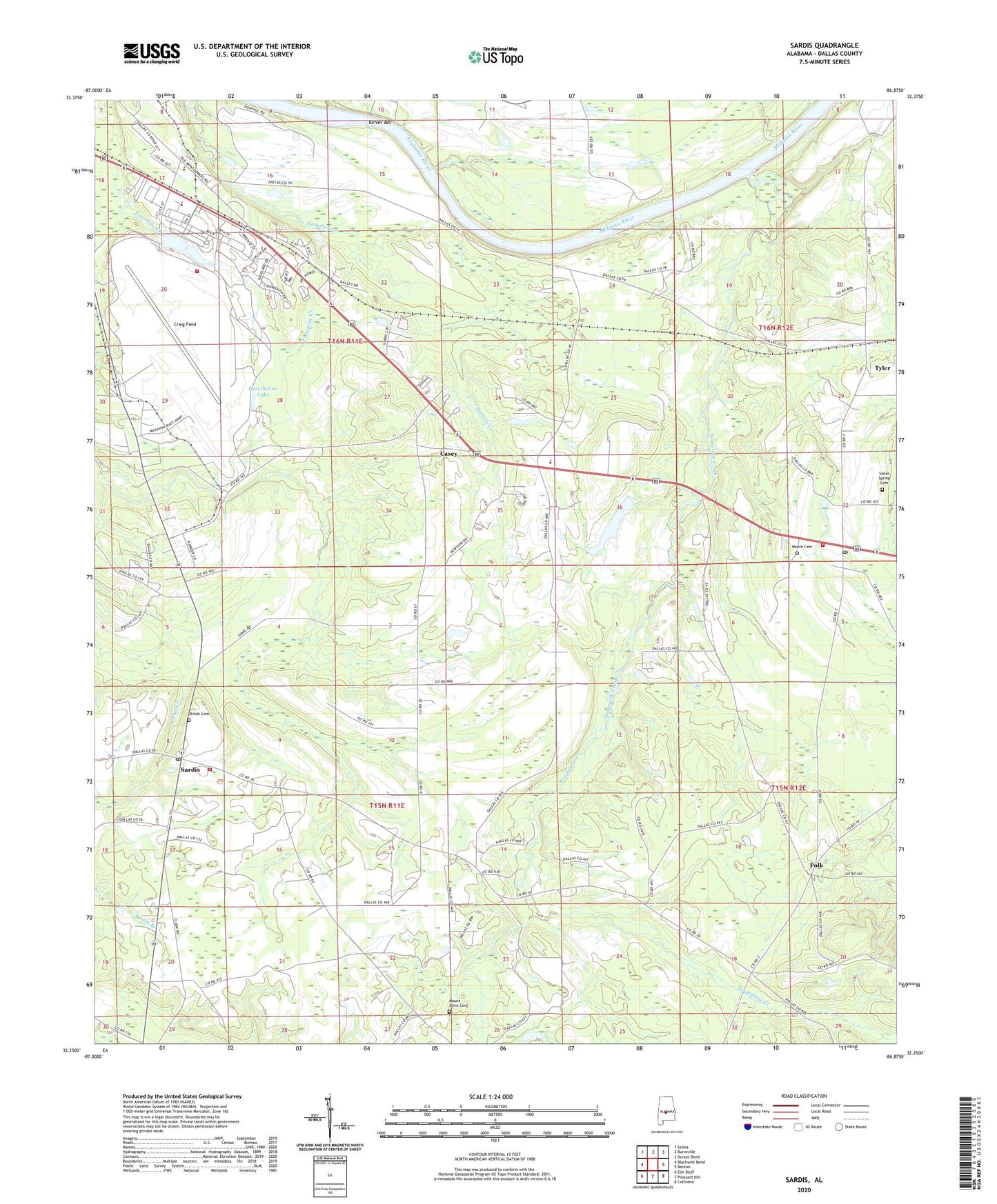
2024 topographic map quadrangle Sardis in the state of Alabama. Scale: 1:24000. Based on the newly updated USGS 7.5' US Topo map series, this map is in the following counties: Dallas. The map contains contour data, water features, and other items you are used to seeing on USGS maps, but also has updated roads and other features. This is the next generation of topographic maps. Printed on high-quality waterproof paper with UV fade-resistant inks.
Quads adjacent to this one:
West: Blackwell Bend
Northwest: Selma
North: Burnsville
Northeast: Durant Bend
East: Benton
Southeast: Collirene
South: Pleasant Hill
Southwest: Elm Bluff
This map covers the same area as the classic USGS quad with code o32086c8.
Contains the following named places: Alabama State Troopers Troop D, Alliance Community Church, Casey, Cosey Church, Craig Air Force Base, Craig Field, Craig Field Fire Department, Craig Field Lake Dam, East Dallas School, East Salem Church, Fredervek Landing, Hawthorne Lake, Isabella Church, King School, Moore Cemetery, Moss Landing, Mount Olive Cemetery, Mount Olive Church, Mount Olive School, New Liberty Baptist Church, New Sister Spring Church, Old Town Creek Church, Pine Flat Church, Plummer Lake, Polk, Sand Ridge Church, Sardis, Sardis Post Office, Sardis Volunteer Fire Department, Selmont Church, Selmont-Tyler Division, Shady Grove Church, Shiloh Baptist Church, Shiloh Cemetery, Sister Spring Baptist Church, Sister Spring Cemetery, Sister Springs School, Soapstone Church, Soapstone Creek, Southside Elementary School, Southside High School, Tarver Bar, Tarvers Landing, Tyler, Tyler Community Club, Tyler Post Office, Tyler School, Tyler Union School, Tyler Volunteer Fire Department, Union Church, Ward Estate Dam, Weaver Woodyard Landing