MyTopo
Pleasant Hill Alabama US Topo Map
Couldn't load pickup availability
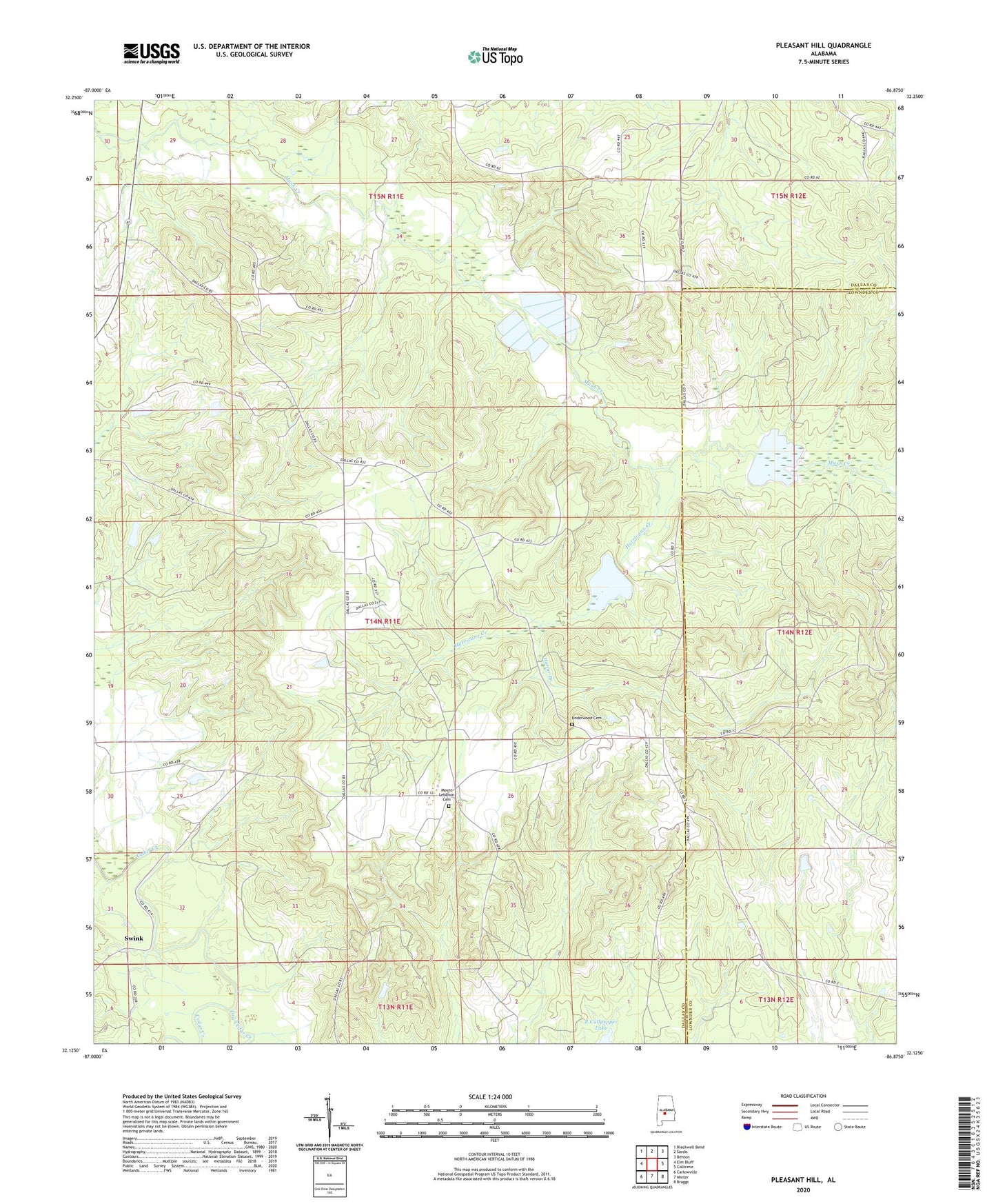
2024 topographic map quadrangle Pleasant Hill in the state of Alabama. Scale: 1:24000. Based on the newly updated USGS 7.5' US Topo map series, this map is in the following counties: Dallas, Lowndes. The map contains contour data, water features, and other items you are used to seeing on USGS maps, but also has updated roads and other features. This is the next generation of topographic maps. Printed on high-quality waterproof paper with UV fade-resistant inks.
Quads adjacent to this one:
West: Elm Bluff
Northwest: Blackwell Bend
North: Sardis
Northeast: Benton
East: Collirene
Southeast: Braggs
South: Minter
Southwest: Carlowville
This map covers the same area as the classic USGS quad with code o32086b8.
Contains the following named places: Berlin Normal School, Bethel Church, Dry Cedar Creek, Good Hope Church, Honor Branch, Hunter School, Hurricane Creek, Kings, Mount Arara School, Mount Ararat Church, Mount Lebanon Cemetery, Mount Sinai Church, Pleasant Hill, Pleasant Hill Presbyterian Church, Pleasant Hill Station, R Cullpepper Dam, R Cullpepper Lake, Saint Luke Church, Sandy Ridge Church, Sinai Hall, Sinai School, Swink, Underwood Cemetery, Wesley Chapel Church, ZIP Code: 36775