MyTopo
Benton Alabama US Topo Map
Couldn't load pickup availability
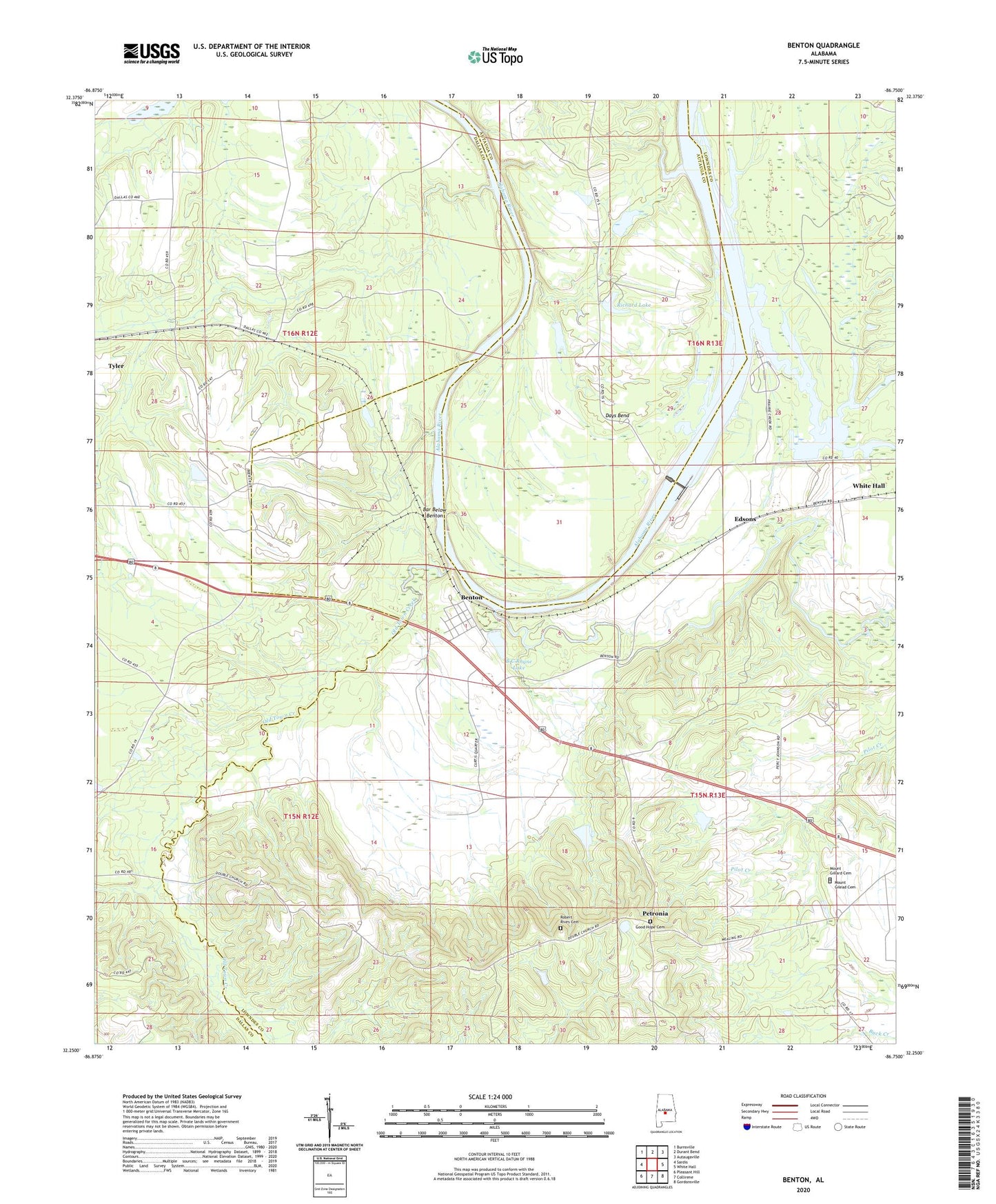
2024 topographic map quadrangle Benton in the state of Alabama. Scale: 1:24000. Based on the newly updated USGS 7.5' US Topo map series, this map is in the following counties: Lowndes, Dallas, Autauga. The map contains contour data, water features, and other items you are used to seeing on USGS maps, but also has updated roads and other features. This is the next generation of topographic maps. Printed on high-quality waterproof paper with UV fade-resistant inks.
Quads adjacent to this one:
West: Sardis
Northwest: Burnsville
North: Durant Bend
Northeast: Autaugaville
East: White Hall
Southeast: Gordonsville
South: Collirene
Southwest: Pleasant Hill
This map covers the same area as the classic USGS quad with code o32086c7.
Contains the following named places: B C Rhyne Dam, B C Rhyne Lake, Bar Below Benton, Benton, Benton Landing, Benton Post Office, Big Elam Church, Big Swamp Creek, Camp Creek, Camp Creek Church, Days Bend, Dulaney School, Edsons, Elam Church, Ellwood Church, Ellwood School, Good Hope Cemetery, Good Hope Church, Gunters Farm, J Smiths Landing, M A Richard Dam, Mount Gilead Cemetery, Mount Gillard Cemetery, Mount Nebo Church, Mount Sinai Church, New Mount Moriah Church, Old Town Creek, Petronia, Pilgrim Church, Pilot Creek, Prairie Creek, Prairie Creek Public Land Use, Richard Lake, Robert F Henry Lock and Dam, Robert Rives Cemetery, Talisi, Town of Benton, Upchurch Lake Dam, Valley Creek, Weeping Willow Church, Wood Landing, ZIP Code: 36785