MyTopo
Hatton Alabama US Topo Map
Couldn't load pickup availability
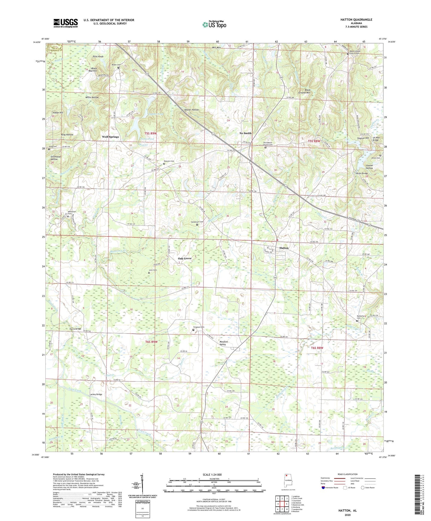
2024 topographic map quadrangle Hatton in the state of Alabama. Scale: 1:24000. Based on the newly updated USGS 7.5' US Topo map series, this map is in the following counties: Lawrence, Colbert. The map contains contour data, water features, and other items you are used to seeing on USGS maps, but also has updated roads and other features. This is the next generation of topographic maps. Printed on high-quality waterproof paper with UV fade-resistant inks.
Quads adjacent to this one:
West: Old Bethel
Northwest: Leighton
North: Town Creek
Northeast: Courtland
East: Masterson Mill
Southeast: Moulton
South: Landersville
Southwest: Newburg
This map covers the same area as the classic USGS quad with code o34087e4.
Contains the following named places: Beavers Cemetery, Beavers Cross, Beavers Cross School, Beck Creek, Black Ground Church, Black Ground Church Cemetery, Black Ground School, Black Wax Hill, Bond Branch, Calvary Baptist Church, Cedar Grove Church, Concord, Concord Church, Concord Post Office, Concord School, Fergason Cemetery, Finney Branch, Flat Rock, Flat Rock Community Center, Flat Rock School, Gum Springs Church, Hardin Bridge, Harris Bridge, Harris Chapel, Hatton, Hatton Census Designated Place, Hatton Church of Christ, Hatton Division, Hatton Elementary School, Hatton High School, Hatton Volunteer Fire Department, Hogwood Branch, Indian Hill, Iron Bridge School, Jetton Cemetery, King Cemetery, Lackey Bridge, Lawrence County Associaton Church Camp, Little Mud Creek, Loosier Hollow, Love Cemetery, Masterson Cemetery, Masterson School, Mount Zion Church, Ne Smith, Ne Smith School, New Zion Church, Oak Grove, Oak Grove School, Oil Well Bridge, Okalona Church, Okolona Baptist Church, Oliver Creek, Pilot Knob, Pool Creek, Pooles Pond, Pooles Pond Dam, Prairie School, Privet Branch, Providence Baptist Church, Providence Church Cemetery, Randolph Branch, Roden Cemetery, Roden School, Rutherford Cemetery, Sanderson Cemetery, Sanderson Chapel Methodist Church, Shaver Hollow, Slayton Hill, Soap Hole Branch, Taylors Dam, Taylors Pond, The Fall Off, Union Hill Missionary Baptist Church, Vickery Lake, Watches Creek, Willis Hollow, Wolf Springs, Wolf Springs Elementary School, Wolfe Spring Church