MyTopo
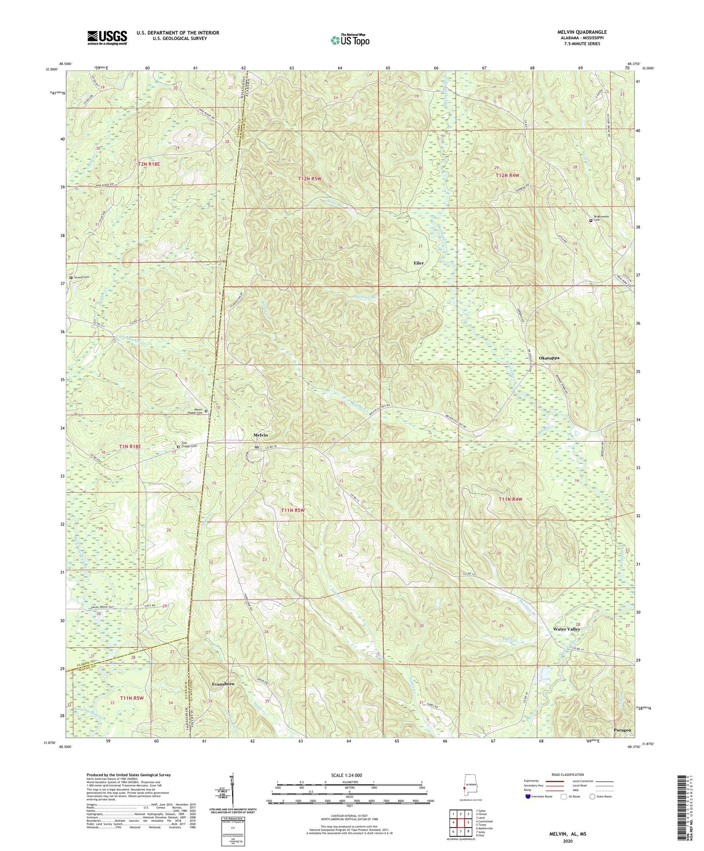
Melvin Alabama US Topo Map
Couldn't load pickup availability
2024 topographic map quadrangle Melvin in the states of Alabama, Mississippi. Scale: 1:24000. Based on the newly updated USGS 7.5' US Topo map series, this map is in the following counties: Choctaw, Clarke, Wayne. The map contains contour data, water features, and other items you are used to seeing on USGS maps, but also has updated roads and other features. This is the next generation of topographic maps. Printed on high-quality waterproof paper with UV fade-resistant inks.
Quads adjacent to this one:
West: Carmichael
Northwest: Sykes
North: Hinton
Northeast: Land
East: Toxey
Southeast: Silas
South: Isney
Southwest: Matherville
Contains the following named places: Belmount Methodist Church, Biddys Creek, Brightwater Cemetery, Brightwater Methodist Church, Bucatunna Creek Oil Field, Church of God, Creek, Ditch Creek, Donald Assembly of God Church, East Langsdale Oil Field, Eiler, Evansboro, Hanging Moss Creek, Hurricane Baptist Church, Little Double Creek, Melvin, Melvin Junior High School, Melvin Oil Field, Melvin United Methodist Church, Miller Branch, Mount Mariah Baptist Church, Mount Pisgah Baptist Church, Mount Pisgah Cemetery, Mount Pisgah School, Okatuppa, Opossum Branch, Pierces Springs, Pierces Springs Church, Shady Grove Church, State Line Church, State Line Methodist Church, Stroud Cemetery, Stroud Line School, Thornton Branch, Trotters Bridge, Turner, Victory Grove Pentecostal Holiness Church, Water Valley, Zion Chapel, Zion Chapel Cemetery, ZIP Code: 36913