MyTopo
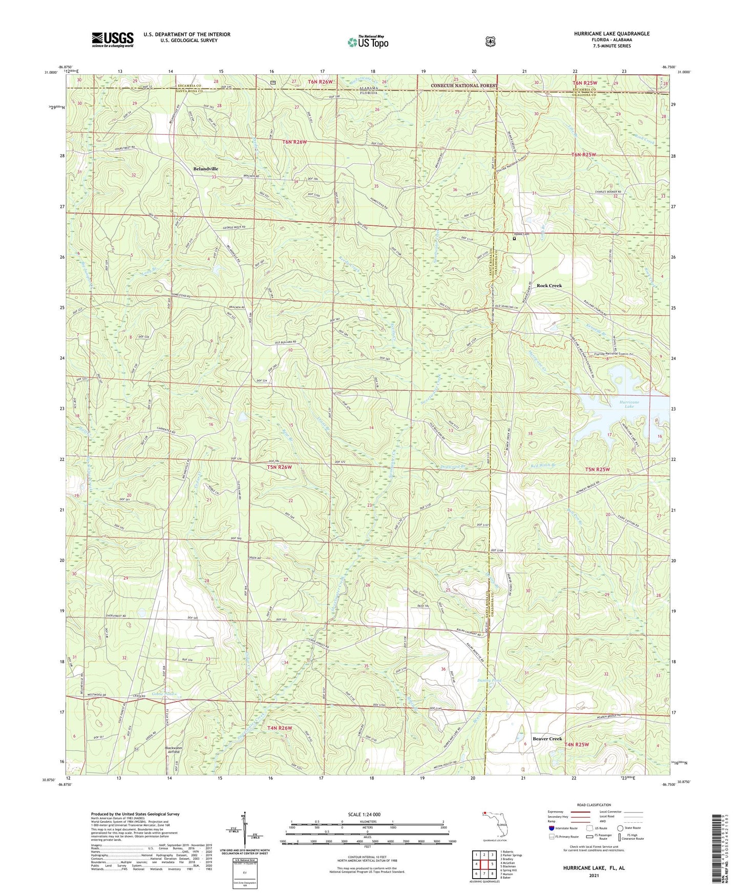
Hurricane Lake Florida US Topo Map
Couldn't load pickup availability
Also explore the Hurricane Lake Forest Service Topo of this same quad for updated USFS data
2024 topographic map quadrangle Hurricane Lake in the states of Florida, Alabama. Scale: 1:24000. Based on the newly updated USGS 7.5' US Topo map series, this map is in the following counties: Santa Rosa, Okaloosa, Escambia. The map contains contour data, water features, and other items you are used to seeing on USGS maps, but also has updated roads and other features. This is the next generation of topographic maps. Printed on high-quality waterproof paper with UV fade-resistant inks.
Quads adjacent to this one:
West: McLellan
Northwest: Roberts
North: Parker Springs
Northeast: Bradley
East: Blackman
Southeast: Baker
South: Munson
Southwest: Spring Hill
This map covers the same area as the classic USGS quad with code o30086h7.
Contains the following named places: Barney Creek, Bear Branch, Beaver Creek, Belandville, Blackwater Airfield, Blackwater River State Forest, Bullard Church, Cedar Creek, Cobb Branch, Crane Branch, Danley Branch, Danley Pond, Dogwood Branch, Goose Pond, Hobbs Cemetery, Hurricane Lake, Line Branch, Long Branch, Mincy Branch, Red Wash Branch, Reedy Creek, Rock Creek, Santa Maria, Valley Grove Church, Verbies Branch, Wolf Creek