MyTopo
Parker Springs Alabama US Topo Map
Couldn't load pickup availability
Also explore the Parker Springs Forest Service Topo of this same quad for updated USFS data
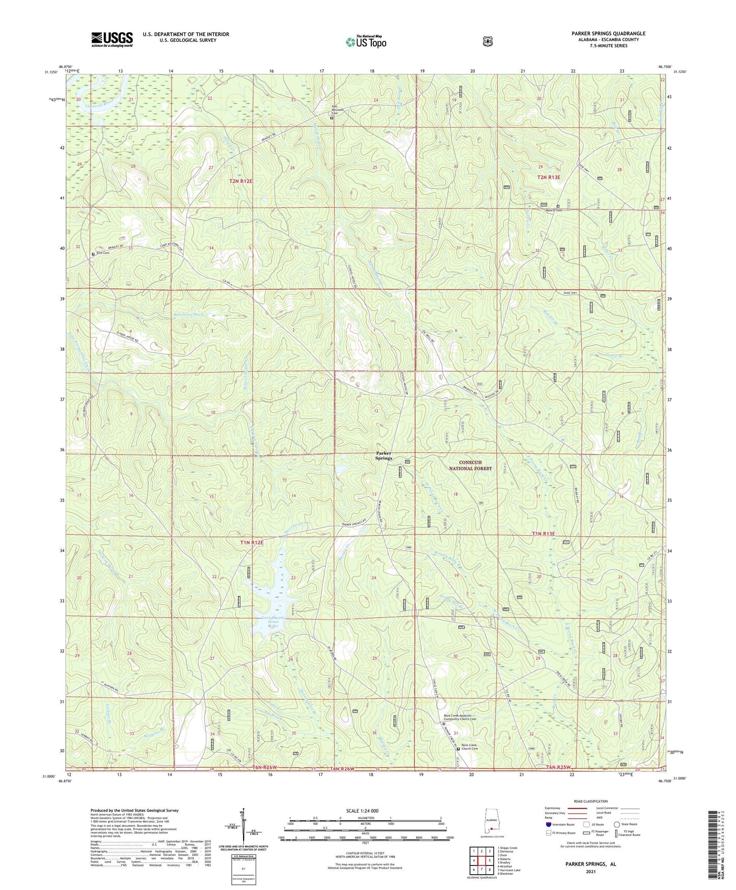
2024 topographic map quadrangle Parker Springs in the state of Alabama. Scale: 1:24000. Based on the newly updated USGS 7.5' US Topo map series, this map is in the following counties: Escambia. The map contains contour data, water features, and other items you are used to seeing on USGS maps, but also has updated roads and other features. This is the next generation of topographic maps. Printed on high-quality waterproof paper with UV fade-resistant inks.
Quads adjacent to this one:
West: Roberts
Northwest: Shipps Creek
North: Damascus
Northeast: Dixie
East: Bradley
Southeast: Blackman
South: Hurricane Lake
Southwest: McLellan
This map covers the same area as the classic USGS quad with code o31086a7.
Contains the following named places: Alaflora, Bay Branch, Beader Branch, Big Brook, Brackens Ditch, Camp Alex, Camp Williams, East Prong Rock Creek, Elim Cemetery, First Marietta Missionary Baptist Church, Floyd Creek, Henley Roberts, Hog Pen Branch, Horse Branch, Leon Brooks Hines Lake, Little Creek, Mancill Cemetery, Mile Branch, New Bethel Methodist Episcopal Church, Parker Springs, Parker Springs Lookout, Rock Creek, Rock Creek Apostolic Community Church Cemetery, Rock Creek Assembly of God Church, Rock Creek Church, Rock Creek Church Cemetery, Sam McGowin Cemetery, Sandy Hill Branch, Wagon Body Branch, West Prong Rock Creek, Wiggins Branch