MyTopo
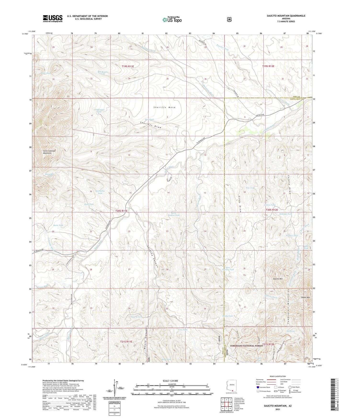
Saucito Mountain Arizona US Topo Map
Couldn't load pickup availability
Also explore the Saucito Mountain Forest Service Topo of this same quad for updated USFS data
2021 topographic map quadrangle Saucito Mountain in the state of Arizona. Scale: 1:24000. Based on the newly updated USGS 7.5' US Topo map series, this map is in the following counties: Pima, Santa Cruz. The map contains contour data, water features, and other items you are used to seeing on USGS maps, but also has updated roads and other features. This is the next generation of topographic maps. Printed on high-quality waterproof paper with UV fade-resistant inks.
Quads adjacent to this one:
West: Cerro Colorado
Northwest: Penitas Hills
North: Batamote Hills
Northeast: Esperanza Mill
East: Amado
Southeast: Tubac
South: Murphy Peak
Southwest: Arivaca
This map covers the same area as the classic USGS quad with code o31111f2.
Contains the following named places: Anne Bee Well, Argentina Well, Basin Tank, Batamote Wash, Bob Brown Tank, Bob Brown Well, Boyd Tank, Calera Draw, Canez Wash, Colorado Wash, Compressor Tank, Coyote Tank, Coyote Well, Cuisanto Well, Ellas Draw, Escondido Well, Fresno Well, Horse Pasture Tank, Horseshoe Tank, K X Ranch, Liebres Tank, Line Tank, Media Well, Moyza Canyon, Moyza Ranch, Mud Tank, New Well Windmill, Old Sopori School, Papalote Alto, Papalote Wash, Penasco Tank, Pete Tank, Proctor Wash, Red Spring, Red Tank, Redondo Tank, Rock Tank, Sandy Tank, Santa Lucia Ranch, Sardina Canyon, Sardina Dam, Saucito Mountain, Saucito Wash, Saucito Well, Sheriffs Draw, Sheriffs Mesa, Sparkplug Tank, Steer Pasture Tank, Surprise Well, Suzy Q Tank, Tres Dedos Well, Wino Tank, ZIP Code: 85645