MyTopo
Batamote Hills Arizona US Topo Map
Couldn't load pickup availability
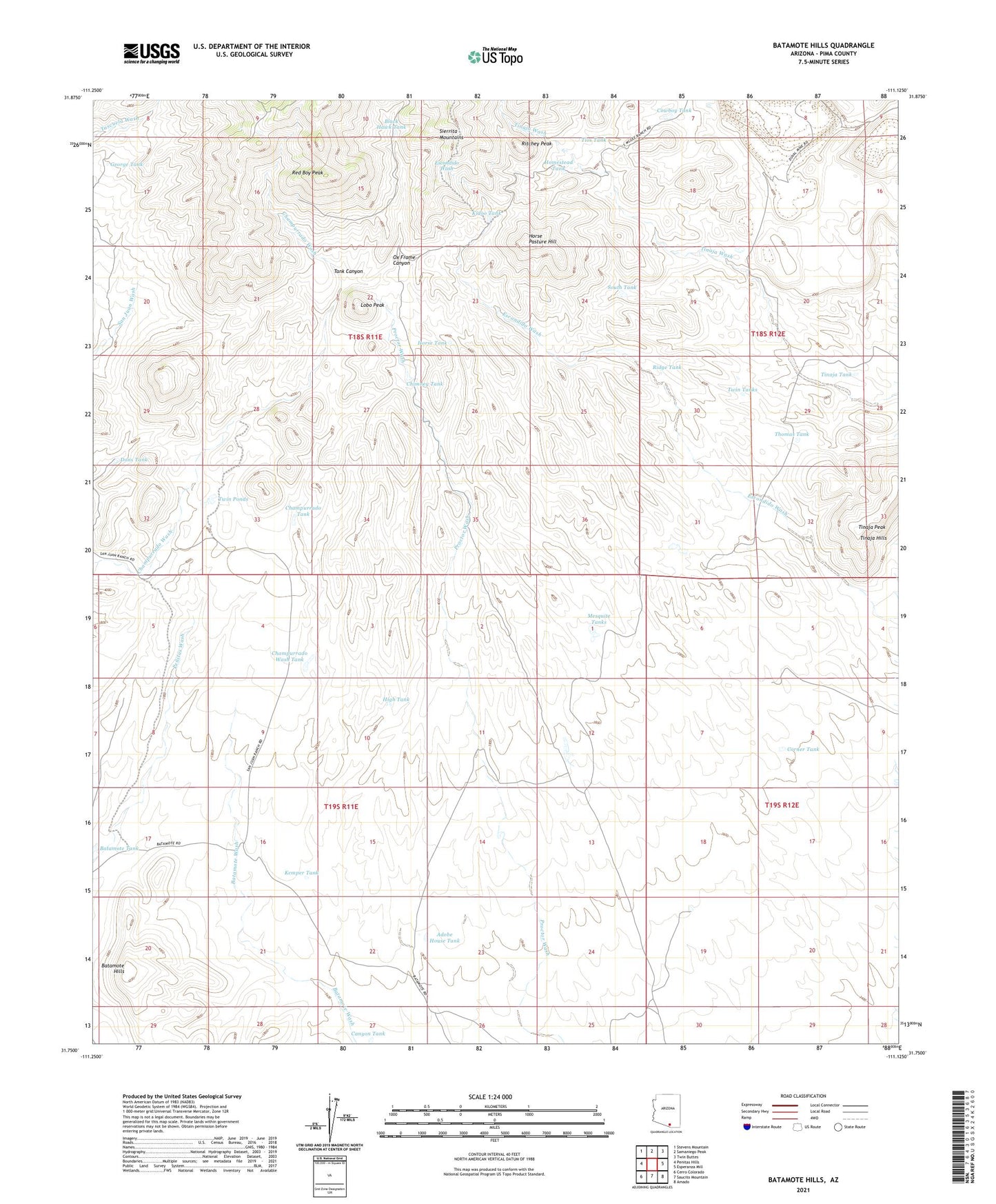
2021 topographic map quadrangle Batamote Hills in the state of Arizona. Scale: 1:24000. Based on the newly updated USGS 7.5' US Topo map series, this map is in the following counties: Pima. The map contains contour data, water features, and other items you are used to seeing on USGS maps, but also has updated roads and other features. This is the next generation of topographic maps. Printed on high-quality waterproof paper with UV fade-resistant inks.
Quads adjacent to this one:
West: Penitas Hills
Northwest: Stevens Mountain
North: Samaniego Peak
Northeast: Twin Buttes
East: Esperanza Mill
Southeast: Amado
South: Saucito Mountain
Southwest: Cerro Colorado
This map covers the same area as the classic USGS quad with code o31111g2.
Contains the following named places: Adobe House Tank, Adobe House Well, Banos Well, Batamote Hills, Batamote Pasture Tank, Batamote Ranch, Batamote Tank, Batamote Well, Black Hawk Tank, Blackhawk Mine, Canyon Tank, Champurrado Tank, Champurrado Wash Tank, Champurrado Well, Chimney Tank, Corner Tank, Cowboy Tank, Dons Tank, Duval Mine, Escondido Well, Esperanza Pit, George Tank, Harris Ranch, High Tank, Homestead Tank, Horse Pasture Hill, Horse Tank, Kemper Tank, Kenny Well, Kidoo Tank, Lobo Peak, Lobo Well, McGee Well, Mesquite Tanks, Ox Frame Canyon, Pila Cerro Well, Red Boy Peak, Ridge Tank, Ritchey Peak, Sierrita Mine East Pit, Sierrita Well, South Tank, Tank Canyon, Thomas Tank, Tinaja Hills, Tinaja Peak, Tinaja Ranch, Tinaja Tank, Tinaja Well, Tios Tank, Twin Ponds, Twin Tanks, White Iron Canyon